
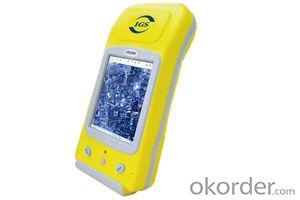
GIS K150
- Ref Price:
-

- Loading Port:
- China Main Port
- Payment Terms:
- TT OR LC
- Min Order Qty:
- -
- Supply Capability:
- -
OKorder Service Pledge
OKorder Financial Service
You Might Also Like


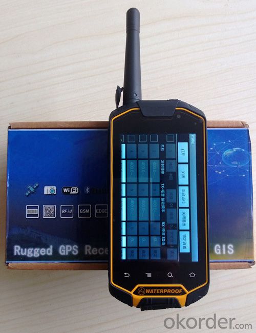
Powerful GPS receiver: GIS-150 has all the handheld GPS functions including global positioning, point collector, real time navigation, information inquiry, data collector, staking out, tacking record and uploading survey sheet, which can totally satisfy use’s outdoor position and navigation needs.
CPU: 1G double core high-speed processor
Operating system: Android OS 4.0
Extended storage: Up to 32G TF storage card
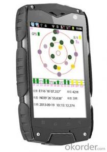
GPS Characteristics
Military standard: MIL-STD 810F
Single machine precision: 3 to 5 meter
Communications
Network model: GSM+WCDMA
Data traffic: GPRS,EDGE,HSDPA,HSUPA,
Support Channels: 2G:GSM850/900/1800/1900
3G:850/1900/2100
Bluetooth: 2.0+EDR
WIFI : 802.11 WLAN
USB: Micro USB v2.0
Display Characteristics
Display: 4.3 inches
Type: Capacitive touch screen
Luminance: High resolution display sunlight readable with touch screen
Resolution: 800×480
Power resource Characteristics
Battery: 3800mAH Li-Ion
Battery Life: up to 12 hours in successively work
Physical Characteristics
Size: 155×75×25mm
Weight: 338g(with battery)
Operating temperature: -20℃~60℃
Storage temperature: -40℃~70℃
Humidity: 100% non condensing
Water and dust proof: IP67
Free drop: 1.5 m
Roll: 1000times 0.5 meters height
Optional Apply
8 million pixel main camera, 0.3 million pixel Secondary camera auto-focusing, video records
built-in microphone records sound
built-in electronic compass
support for multiple GPS intelligent data acquisiton software
- Q: What factors affect the handheld GPS receive signal?
- Active ionosphere, large canopy, high voltage wire, high building.... Have influence.
- Q: Handheld GPS positioning, can be directly uploaded to the computer, and the computer has a scalable map to mark the upload point. The above system, now there are 20Such as the title, I want to achieve the final function: through the manual to a point, with a hand-held GPS locator will be recorded in the specific latitude and longitude, and sent to the network in real time, for my computer to mark these points on the map. If you can directly enter the site of some of the information, directly to the above is the bestIf you have the above equipment, please indicate the scientific name, and the specific application industry.Thanks.
- 13 support GPS satellite positioning function, the need to connect GPS satellite positioning hardware devices (USB GPS devices or Bluetooth GPS devices; tablet PC).14 support offline map pack custom download function, you can download the map anywhere in the world.
- Q: Can you buy a good handheld GPS in China? FiveTrouble master recommended several professional handheld GPS brand, in addition to handheld GPS can speed it? Thank you!!
- If it is used, there is no difference.
- Q: Handheld GPS locator measuring accuracy is about how many meters?
- The handheld machine precision is generally divided into: centimeter decimeter level, 1 meters, 2 meters, 3 meters, 5 meters;
- Q: What is the difference between industrial GPS handset and mobile navigation
- I am a professional to do GPS, the difference between the professional handheld and mobile GPS is very understanding, here and your simple communication.1, GPS is the most important positioning accuracy and confidence. Professional handheld GPS chip used to stabilize the performance of some, the accuracy will be better, such as Garmin handheld high-end product positioning can be achieved within 3 meters, while the phone's GPS chip is different.2, both in the design and positioning of the crowd is very different. Professional GPS more focus on outdoor industry and users, the use of design idea is how to better outdoors, outdoor tourism including tourism exploration assistant very full function, and mobile phone GPS is a trend not only, what purpose.
- Q: What is GPS Mu meter ah, with the general said that the GPS measuring instrument what is the difference?
- The amount of words on the handheld GPS, Magellan can be both economic and affordable.
- Q: How do I still stay in the GPS navigation, GPS monitoring of the primary idea? FiveBusiness services, thank you!Future business services
- Mainly for the ship, automobile, aircraft and other moving objects positioning navigation. For example:1 ocean navigation and incoming water diversion2 aircraft route guidance and approach landing3 vehicle autonomous navigation4 ground vehicle tracking and urban intelligent traffic management5 emergency rescue
- Q: Welcome to make comments on the existing GPS tour pal what shortcomings to answer the more detailed the better
- The first three factors: ability as a good tour pal, sun and rain fearless tramp over mountains and through ravines Rulvpingdi, GPS, his nature can not be weak, small knock a small touch can not have temper, off or out in the water dirty, also to be able to continue the work. So the waterproof / earthquake / dust and other indicators become the primary consideration factors GPS these are the protective ability of vehicle GPS, most of them do not have, and some professional GPS design, there will be more conducive to the harsh environment, such as some of the products designed to be capable of floating after falling into the water. The outdoor need to step back. What is it, if you can not do to prevent flooding, then rain proof ability is the minimum requirement.
- Q: In addition to the parameters, that is the problem of the machine, what method can reduce the error of these two machines to a minimum. Because, at the same time to find a coordinate. The gap is too big.
- GPS was in error with 10 meters, with the star search results, related to the environment, if the precision is high, as long as the use of handheld GPS submeter or handheld RTK
- Q: The navigation module it is "selph" three generation? Another one I mainly use it to measure the land area, easy to use, the error is not big?I want to buy Magellan 500 do not know whether it is good to use
- Professional handheld GPS only Magellan and set SIBAO
Send your message to us
GIS K150
- Ref Price:
-
- Loading Port:
- China Main Port
- Payment Terms:
- TT OR LC
- Min Order Qty:
- -
- Supply Capability:
- -
OKorder Service Pledge
OKorder Financial Service
Similar products


Hot products


Hot Searches

