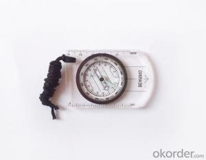
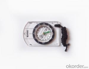
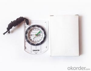
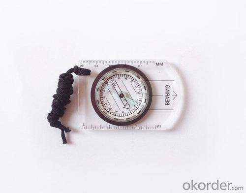

Plastic Map or Ruler Compass for Surveying
- Ref Price:
-

- Loading Port:
- Tianjin
- Payment Terms:
- TT OR LC
- Min Order Qty:
- 20 pc
- Supply Capability:
- 10000 pc/month
OKorder Service Pledge
OKorder Financial Service
You Might Also Like


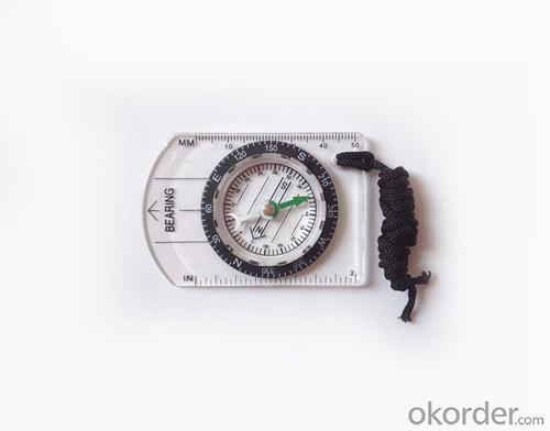
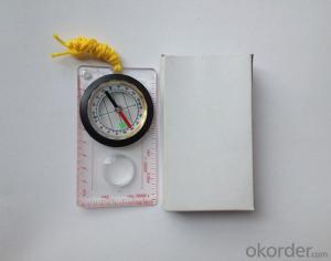
Model: DC35-1B
Name: Professional map compass, ruler compass
Product Origin: China
Supply Ability: 10,000 pcs/month
Minimum Order: 50 pcs
MOQ for OEM package: 500pcs
Product Size: 70*48*9 (mm)
Features of DC35-B
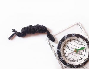
1, professional usage: orientation, distance measuring, measuring slope, azimuth and pitching Angle measurement, drawing, a magnifying glass
2, high quality compass with neck rope, portable and rugged
3, ACRYLIC material, about 2mm thick
4, Damping Dial: to keep the stability of the pointer, more suitable for outdoor environment.
5, Accuracy: accurate and clear, there were 360 degrees azimuth Angle, outer ring is 64-00 system, Liquid filled in the compass for reliable readings.
6, Magnifier function
5,ruler compass,
6,for map measure and drawing
7,one meter neck rope,
8,Liquid filled in the compass for reliable readings,
9, magnifier function.
- Q: What factors affect the handheld GPS receive signal?
- Active ionosphere, large canopy, high voltage wire, high building.... Have influence.
- Q: GPS Mu meter which brand is good, handheld high-precision land area measuring instrument
- A German born mu can also recommend a good precision measuring instrument.Simple operation, the screen is large, a few buttonsBoot, and then look at the star almost, to find a field, start and then click on the end of a circle, out of the number ofElectricity can alsoPrecision mody... With a special RTK or not, but what is sure to measure a circleFlat measurement of quasi accurate, biased on what is almost, it can be accepted
- Q: I am a handheld GPS precision is low, how to use to be able to improve certain accuracy.
- If you can join the CORS network, the accuracy of decimeter to centimeter level.
- Q: Jia Ming etre20 handheld GPS good
- Jia Ming eTrex 20 has a microSD card slot and 1.7GB built-in memory space eTrex 20 allows you to store more user acquisition information, in addition to the map expansion slot, you can load the map of the global area of Garmin.
- Q: How do I still stay in the GPS navigation, GPS monitoring of the primary idea? FiveBusiness services, thank you!Future business services
- Mainly for the ship, automobile, aircraft and other moving objects positioning navigation. For example:1 ocean navigation and incoming water diversion2 aircraft route guidance and approach landing3 vehicle autonomous navigation4 ground vehicle tracking and urban intelligent traffic management5 emergency rescue
- Q: Welcome to make comments on the existing GPS tour pal what shortcomings to answer the more detailed the better
- The first three factors: ability as a good tour pal, sun and rain fearless tramp over mountains and through ravines Rulvpingdi, GPS, his nature can not be weak, small knock a small touch can not have temper, off or out in the water dirty, also to be able to continue the work. So the waterproof / earthquake / dust and other indicators become the primary consideration factors GPS these are the protective ability of vehicle GPS, most of them do not have, and some professional GPS design, there will be more conducive to the harsh environment, such as some of the products designed to be capable of floating after falling into the water. The outdoor need to step back. What is it, if you can not do to prevent flooding, then rain proof ability is the minimum requirement.
- Q: In addition to the parameters, that is the problem of the machine, what method can reduce the error of these two machines to a minimum. Because, at the same time to find a coordinate. The gap is too big.
- GPS was in error with 10 meters, with the star search results, related to the environment, if the precision is high, as long as the use of handheld GPS submeter or handheld RTK
- Q: How about the accuracy of the GPS handset?
- So the selection depends on your needs the function and budget. Haida official website mall "mobile MGIS mall".
- Q: How to hand GPS eTrex H data to the computer
- "Shaanxi skmax navigation information Limited" GARMIN proxy (GARMIN official website can be found), contact (Xiao Hou) the hope can help to you, if you do not understand what we see on the Internet, may at any time, contact us!
- Q: How to upgrade handheld navigator
- Some 4S shop can;Read the instructions, there are generally USB mouth, then you can upgrade the computer practice;There is a memory card, then you can remove the plug on the computer upgrade;Or get the computer city to see it.
Send your message to us
Plastic Map or Ruler Compass for Surveying
- Ref Price:
-
- Loading Port:
- Tianjin
- Payment Terms:
- TT OR LC
- Min Order Qty:
- 20 pc
- Supply Capability:
- 10000 pc/month
OKorder Service Pledge
OKorder Financial Service
Similar products


Hot products


Hot Searches

