


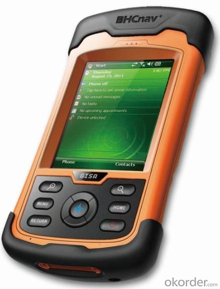
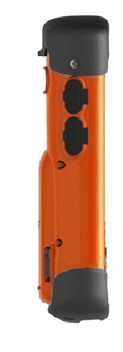
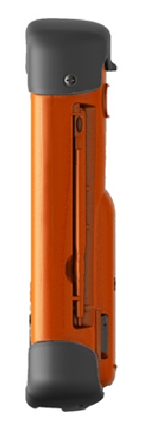
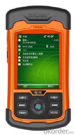
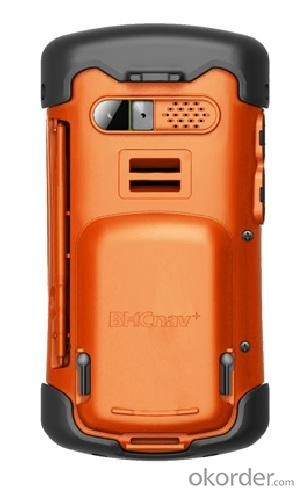
M20 GISA DATA COLLECTOR
- Ref Price:
-

- Loading Port:
- China Main Port
- Payment Terms:
- TT or LC
- Min Order Qty:
- 1 unit
- Supply Capability:
- 1000 Sets per Month unit/month
OKorder Service Pledge
OKorder Financial Service
You Might Also Like


Products Features:
The Most popular handheld GIS Data Controller with communication module.
Professional and Industrial GIS Controller.
Flexible operation system:--Windows Mobile 6.1/Windows Mobile 6.0.
Multi-interface for data transfer.
Excellent communication module.
Specification:


Remarks:
1. Specifications subject to change without notice.
2. Accuracy and reliability depend on the quality of GPS signal and working environment.
3. Battery life time and charge cycles will vary with conditions and environment of use.
4. Software may vary depending on configuration.
5. Weight varies from configurations and optional accessories.
Certificates:

Standard Packing:
GISA device
•Li-ion battery
•AC power adapter
•USB cable
•Handheld strap
•Stylus pen with string
•Screen protector
•Quick guide
•Inspection card
•CD
•4G micro SD card
Application:

Utilities: Underground asset mapping and inspection, water network modelling, as-built mapping of lines/cable installations, and incident/outage reporting.
Local government: High-density urban asset mapping, underground asset relocation, municipal asset inventory and inspection.
Environmental management: Weed management, water debris management, pollution mapping, environmental incident mapping, sample gathering, agricultural subsidy determination.
Warranty Period:
12 months after the delivery time from our factory.
After Sale Service:
After Sale, We provide free technical support via e-mail, skype chatting, telephone or video if necessary. Or you could also dispatch your engineers to our company, we can offer free training face to face. You should please bear the air tickets and all costs when staying in China. We offer additional accessories if you need. But the additional accessories will be charged.
Notices:
1. All our field software free of charge.
2. We have most of our products in stock and samples are available.
3. MOQ is one set.
4. For large quantity, we accept OEM production(printing customer's logo on the products)
Delivery:

- Q: What factors affect the handheld GPS receive signal?
- Active ionosphere, large canopy, high voltage wire, high building.... Have influence.
- Q: Handheld GPS buried in the soil there is a signal
- It depends on how deep you buried the darker the GPS signal, and must ensure that the GPS antenna upward, the above can not be covered with metal objects
- Q: Is it accurate to measure highway mileage with GPS handheld
- As long as you can receive more than four satellites, and the signal is good, the accuracy should be high.
- Q: How to set the handheld GPS related parameters and coordinate conversion parameters throughout the country
- Collect the application area of high grade control data in GPS receiver applied earth area (such as a county) find three (or more) uniform grade (accuracy better) or GPS "B" network, the best point is around without interference of electromagnetic wave, vision, the satellite signal is strong. To the local surveying and mapping management department (such as: the local bureau of Surveying and mapping, surveying and Mapping Institute) Gauss plane coordinate copy these points of the Beijing 54 Coordinate System (x, y), the elevation of H and WGS-84 coordinates of the geodetic coordinates (B, L), the high H.
- Q: What is the difference between professional GPS handsets and mobile navigation?
- GPS is the most important positioning accuracy. Professional handheld machine with industrial design. First of all, if used outdoors, then fell, and so on are likely to water, and this thing is also very expensive, so the opportunity to have a high professional anti shock waterproof performance.
- Q: I am a handheld GPS precision is low, how to use to be able to improve certain accuracy
- Look at the maximum accuracy of GPSIf the difference accuracy can reach 1cm you can connect CORS single base station and other network RTK way to achieve the corresponding accuracy
- Q: Saying that we have a project in front of it is to do so, it is surprising that there are wood
- It is really unexpected, basically not, the accuracy is not enough!
- Q: Fuxin coordinates with the mapping of the seven parameters are what ah there is no professional knowledge to tell my brother I need to fill the gps... Thanks.
- Three translation parameters Delta X, Delta Y, Delta Z, three rotation parameter w X, Omega Y, Omega Z and a zoom M, these parameters need to be calculated in a fixed point under different ellipsoid!
- Q: The navigation module it is "selph" three generation? Another one I mainly use it to measure the land area, easy to use, the error is not big?I want to buy Magellan 500 do not know whether it is good to use
- A type specific.GPS chip area measurement is the most "selph" 3 generation, special machine is very good, the error is very small.
- Q: What is the difference between professional navigation and professional GPS navigator
- 1 high precision, good signal.Now GPS hardware precision is about 10 meters, the difference should be small. The accuracy of the practical application is also affected by the electronic map software. Signal does have good or bad, mainly in the fast positioning is not fast, stable, etc..2 long standby time, voice prompt.Standby time mainly to consider two factors. First, the battery capacity is large, two is the best battery is replaceable. PDA class GPS and vehicle navigation generally have voice prompts. This voice prompt is realized by navigation software.
1. Manufacturer Overview
| Location | Beijing, China |
| Year Established | 2004 |
| Annual Output Value | Below US$1 Million |
| Main Markets | Mid East; Northern Europ;Africa; Southeast Asia |
| Company Certifications | RoHS;CE;FCC;CCC;ISO |
2. Manufacturer Certificates
| a) Certification Name | |
| Range | |
| Reference | |
| Validity Period |
3. Manufacturer Capability
| a) Trade Capacity | |
| Nearest Port | Tianjin; Qingdao |
| Export Percentage | 1% - 10% |
| No.of Employees in Trade Department | 500-999People |
| Language Spoken: | English; Chinese |
| b) Factory Information | |
| Factory Size: | Above 50,000 square meters |
| No. of Production Lines | Above 8 |
| Contract Manufacturing | OEM Service Offered;Design Service Offered |
| Product Price Range | High;Average |
Send your message to us
M20 GISA DATA COLLECTOR
- Ref Price:
-
- Loading Port:
- China Main Port
- Payment Terms:
- TT or LC
- Min Order Qty:
- 1 unit
- Supply Capability:
- 1000 Sets per Month unit/month
OKorder Service Pledge
OKorder Financial Service
Similar products


Hot products


Hot Searches
Related keywords

