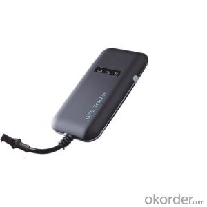
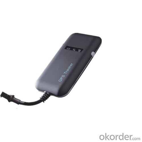
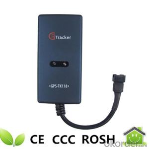
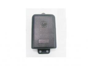
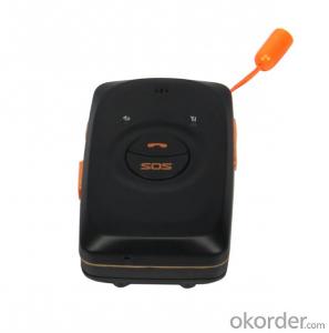
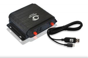
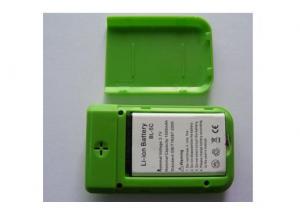
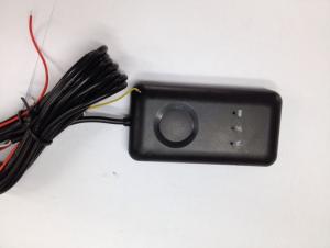
Motorcycle/Bike GPS Tracking Device
- Ref Price:
-

- Loading Port:
- China Main Port
- Payment Terms:
- TT OR LC
- Min Order Qty:
- -
- Supply Capability:
- -
OKorder Service Pledge
OKorder Financial Service
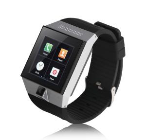
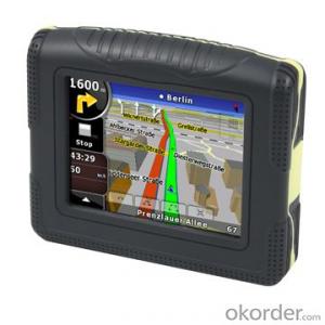
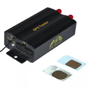
You Might Also Like


Motorcycle/Bike GPS Tracking Device
Applied Range:
Ø Prevention of burglary and position for the scooter/motorcycle/vehicle/logistics industry/mechanical equipment
Ø Outworker management
Ø Criminal detection and hidden tracking
Functions:
Ø Network checking position
Ø Mobile phone checking position
Ø Location and tracking
Ø Power on/off detection(optional)
Ø Cut off the power of the car and alarm(needs built-in battery, optional)
Features:
Ø Simple to use(Just controlling the cell phone)
Ø Easy installation, it will work when linking-up the power supply
Ø Inquiry for the current address with real street name by telephone
Ø Easy to hide (built-in GSM and GPS antennas)
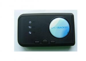
Specifications:
| Specs. | GPS Tracker |
| GSM Frequency | 850/900/1800/1900MHz |
| GPRS | Class 12, UDP |
| GPS Module | SiRF Star III |
| GPS Channels | 20 |
| GPS Sensitivity | -159dBm |
| Acquisition Sensitivity | -144dBm |
| GPS Location Precision | 10 meter(2D RM) |
| GSM Location Precision | 50-300M |
| Speed Precision | 0.1m/s |
| Working Voltage | 9-24V DC |
| Working Current | About 22mA(12v DC) |
| Working Temperature | -20 centigrade to +70 centigrade |
| Working Humidity | 20%-80%RH |
| Maximum Elevation | 18000M |
| Maximum Speed | 515m/s |
- Q: Car GPS positioning tracker shows how offline
- 2, locator no cell phone signal. Dial the phone number through the phone locator, if the prompt can not be connected, not in the service area, this is the case. As far as possible to stop the car in a better signal environment. The positioner mounting position not too closed, do not have the metal of the block, installed on the car to rely on. In the underground garage, tunnel, remote occlusion and other areas without cell phone signal, will lead to the locator off line
- Q: I bought a real carpenter car GPS locator, and then I clearly insert the boot how to display is not enabled? Which God knows?
- (3) it is necessary to insert the card before the boot, the boot state will not be able to identify the card can not be used properly(4) to see if there is no electricity, the equipment charge.
- Q: GPS locator useful in the basement?
- There is no effect, because the tall buildings and hidden rooms, basements will block the satellite, satellite information lost.GPS locator is built-in GPS terminal module and a mobile communication module, GPS module for positioning data obtained at Internet on a server through the mobile communication module, which can realize the query terminal location on a computer or mobile phone.Principle: the spatial distribution of the GPS is composed of 24 GPS working satellites, these GPS working satellites together constitute the GPS satellite constellation, of which 21 are available for navigation of the satellite, the 3 for the active backup satellites. The 24 satellites are distributed around the earth in 6 orbits with an angle of 55 degrees. The cycle of the satellite is about 12. Each GPS working satellite sends out a signal for navigation and positioning. GPS users are using these signals to work.
- Q: Car GPS locator which is good
- So, don't listen to other people say bad, oneself choose.
- Q: How to open the iPad location service
- 3G version of the direct GPS positioning with second steps to locate the service that isWiFi version of the iPad I buy GPS modules related to precise positioning
- Q: The vehicle must renew it in the seller GPS.
- system deviceA. support Android Android, Windows Mobile system thousands of smart phones, smart phones with GPS basic compatible platform system.B. compatible with most of the GPS vehicle positioning terminal, providing the elderly, children's customized mobile phones, support for the positioning of the watch terminal, support handheld mobile GPS positioning terminal.C. supports Internet access, through the application of intelligent terminals to support mobile Internet access, fully support the three operators 2G, 3G network.D. electronic map: Google map and high moral map.
- Q: I would like to do a GPS positioning system to monitor the location of parking spaces within the car loading GPS locator console display map and the location of the vehicle on the map
- Simple to do with ah to find a company to buy hardware equipment to provide management platformAolei technology consulting.
- Q: The simplest and easiest language to say. Do not professional, do not understand......
- Whether it is GPS or A-GPS, are mainly to receive satellite navigation signal using GPS navigation chip equipment, and GPS chip receiving satellite navigation signals are free of charge, but the positioning time is very slow, because it will take a few minutes to wait for a satellite to locate the GPS module to the navigation on your device. A-GPS based on the receiving satellite navigation signal, but also through the network (GPRS) to get you the instant communication equipment operation base station information (signal base seat), you can easily find the instant seat, let the satellite fast positioning of your equipment. So the A-GPS than the GPS positioning time soon.
- Q: How to use the vehicle GPS positioning system
- Install GPS positioning device to the car, you can locate and monitor the vehicle through the positioning platform or mobile phone app.
- Q: Method of use of GPS
- 2 no map use. 1) the use of road point: commonly used to determine the coordinates, to determine the rock caves as starting point, line or other coordinates, the coordinates of the point of turning. Easy to use, MARK a coordinate on the line. Find a point: to find the location must have to sign (landmark/waypoint) exists in the form of GPS in the memory, you can MARK or from previously visited a friend to get data, manual / computer into sign data upload. Press the GOTO key to select your destination from the list, and then go to the "guide" page, which will show you away from the target distance, speed, direction of the target angle and other data, according to the direction angle can be. 2) use the route input route: if you can find the route information recorded by the previous friends, type them into the GPS to form a line, or (usually return to the original road) to edit the previously recorded road sign into a line. Route guidance: put a route according to the activation, and looking for "the same way," guidance "page will lead you to the first point, the route once arrived, the target will automatically replace the next road," guidance "page to lead you to the line of second points if you deviate from... The route over some intermediate point, once you go back to the line," targeting "you will skip around those points, for your current position corresponding to the next point on the line. 3) backtracking is actually a special method of input line (route), it is very easy to return to the original path.
Send your message to us
Motorcycle/Bike GPS Tracking Device
- Ref Price:
-
- Loading Port:
- China Main Port
- Payment Terms:
- TT OR LC
- Min Order Qty:
- -
- Supply Capability:
- -
OKorder Service Pledge
OKorder Financial Service
Similar products

Hot products

Hot Searches
Related keywords

