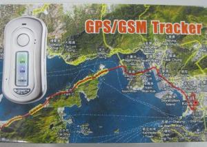


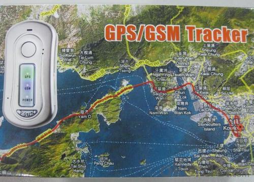


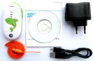
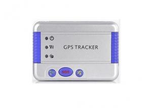
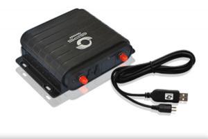
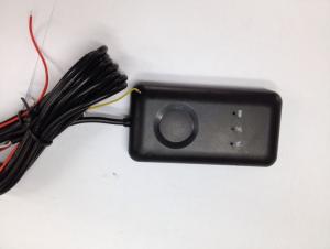
GPS Personal Tracker V530
- Ref Price:
-

- Loading Port:
- China Main Port
- Payment Terms:
- TT or LC
- Min Order Qty:
- 1 Set unit
- Supply Capability:
- 5000 Sets Per Month unit/month
OKorder Service Pledge
OKorder Financial Service
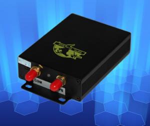
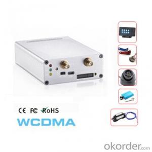
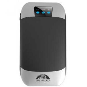
You Might Also Like
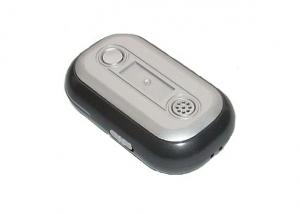


Brief Introduction
V530 portable GPS tracker is a mini remote positioning tracking device based on GPS technology and GSM/GPRS
technology. It receives the latitude and longitude of the user’s location through cell phone messages and then locates
the tracker on Google Map or other digital map software; or positioning data is uploaded by the tracker to the specified
server through GPRS, and the user may search the real-time position and historical track of the tracker on the internet.
This product is widely used in the aged and the children care, property safeguard, animal tracking, etc.
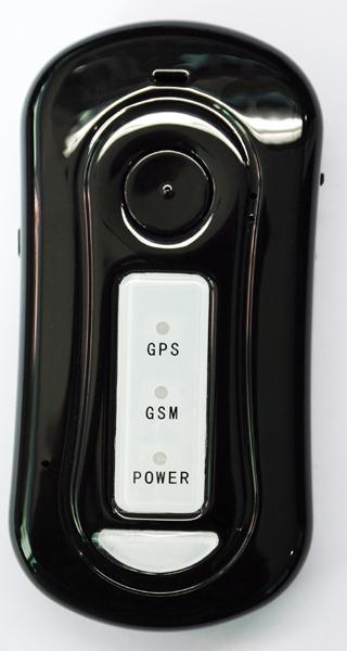
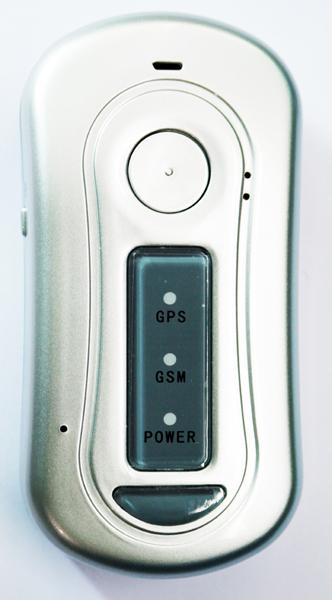
Product characteristics
1. Built-in high-performance GPS chipset enables the product to provide accurate positioning in the event of weak signal
and to work normally in urban area, valleys or other sight-limited districts.
2. Built-in GSM/GPRS model supports GSM900/1800MHz (850/1900 MHz), thus it can work throughout the world.
3. It supports SMS communications or GPRS TCP connection, and receives position information through cell phone
message or used to look into movement track on internet.
4. It provides SOS function.
5. It is equipped with highly reliable electric circuit design and complies with GSM cell phone international standards.
6. It is portable, mignon and low power consumption.
Specifications
|
Hardware |
Parameter |
|
GSM module |
MTK GSM/GPRS chipset GSM 900/1800 double frequency , or GSM 900/1800/850/1900 four frequency (optional) Supports TCP protocol |
|
GPS chip |
GPS chip set with high sensitivity |
|
GPS sensitivity |
-160dBm |
|
GPS frequency |
L1,1575.42MHz |
|
Code |
C/A Code |
|
Channel |
210-channel, omnibearing tracking |
|
Position accuracy |
10 meters, 2D RMS |
|
Speed accuracy |
0.1m/s |
|
Time accuracy |
1us and synchronous with GPS time |
|
Coordinates |
WGS-84 |
|
Reacquisition |
0.1s on average |
|
Hot start |
1s on average |
|
Warm start |
38s on average |
|
Cold start |
42s on average |
|
Altitude Limit |
Maximum 18,000 meter (60,000 feet) |
|
Velocity limit |
Maximum 515m/s (1000 knot) |
|
Acceleration Speed limit |
Less than 4g |
|
Working temperature |
-25℃to 70℃ |
|
Humidity |
5%~95% non-concretion |
|
Dimension |
95mm×46mm×18mm |
|
Voltage |
1300mAh, rechargeable battery(3.7V) |
|
Charger |
DC 5V |
- Q: I drive a friend's car, I want to know if his car is a satellite positioning system, in the absence of his case, how can I know?
- Correct upstairs:1 car butt probe is reversing radar or camera, and GPS unrelated.2.GPS general built-in antenna. In short, the outside can not see.3 large screen LCD screen is a necessary condition for GPS, but not a sufficient condition...Conclusion: depending on the host system interface there is no GPS menu.
- Q: Which kind of GPS locator is better, generally how much money?
- This is only more than and 100 you can go to see Huizhi Albert PG02 Alibaba,Shenzhen, okay, I spent almost a year.
- Q: GPS locator platform to show off how is going on
- GPS locator platform display offline two cases:First, the GPS locator dropped (wiring) can not electrify.
- Q: What is the GPS locator wireless network
- I would like to use the phone againMarket to buy a few hundred dollars GPS using satellite positioning plug-in computer drive using a simple point with electromagnetic wave positioning esoteric
- Q: What is the car anti-theft locator?
- GPS system called "global positioning system", in fact, this technology is the United States spent $about 10000000000, which lasted more than 20 years of development of a large space engineering, the initial use of the main war. Later, GPS technology in the field of non military has been more in-depth application, in the field of automotive anti theft security achieved practical results. GPS satellite positioning system is a network type anti-theft device, it mainly depends on the purpose of locking ignition or starting to achieve security. GPS main use of satellite monitoring center of the vehicle 24 hours uninterrupted, high-precision monitoring services. GPS mobile terminal of the system installed in the command center of the central control system, mounted on the vehicle and GSM communication network, receiving location information from global positioning satellites, calculates the longitude, latitude, speed and direction of moving targets, and the use of short transmission information platform GSM network as the communication medium to achieve the positioning information the. This all-weather service is very effective, but its shortcomings are obvious: the price is expensive, a monthly fee to pay a service fee.
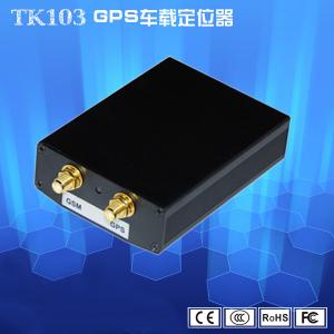
- Q: The difference between the built-in antenna and external antenna of GPS positioning equipment
- External antenna: separate equipment and antenna device consists of a host, a signal line, power line, this kind of equipment for external signal line, can be placed closer to the sky outside the range, so the signal and stability will be much better, the accuracy will be better.
- Q: Does UUGPS have an anti - rejection tracking locator?
- In other words, the city of Shenzhen science and Technology Industrial Co., Ltd. production are good
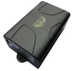
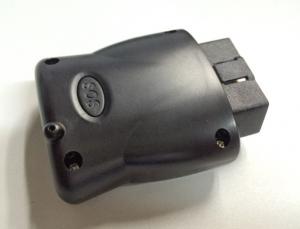
- Q: How to install and use car GPS locator
- Car GPS positioning tracker from simple to difficult to be divided into three main categories: OBD interface, with strong magnetic, wiring (and there are different functions, functions, wiring is a little bit complicated);1).OBD interface installation is very simple, just like an GT500 grain car, just plug in the steering wheel below the OBD port can be
- Q: Do not return the data through the operator GPRS is simply relying on the GPS locator to transfer data, if there are many GPS locator, how to know that locator is what you want,For example, A has a GPS locator body, A home must have a receiving device. In addition B had a B locator, the home also has a receiving device, receiving device is how to know B A's or B's body. A similar pair, do you understand
- It is only in a certain range (such as 10km) using the short distance wireless communication, which does not require the support of GPRS, like a battlefield combat squad is much too far away? Only with high power directional antenna or satellite antenna.
- Q: Method of use of GPS
- 2 no map use. 1) the use of road point: commonly used to determine the coordinates, to determine the rock caves as starting point, line or other coordinates, the coordinates of the point of turning. Easy to use, MARK a coordinate on the line. Find a point: to find the location must have to sign (landmark/waypoint) exists in the form of GPS in the memory, you can MARK or from previously visited a friend to get data, manual / computer into sign data upload. Press the GOTO key to select your destination from the list, and then go to the "guide" page, which will show you away from the target distance, speed, direction of the target angle and other data, according to the direction angle can be. 2) use the route input route: if you can find the route information recorded by the previous friends, type them into the GPS to form a line, or (usually return to the original road) to edit the previously recorded road sign into a line. Route guidance: put a route according to the activation, and looking for "the same way," guidance "page will lead you to the first point, the route once arrived, the target will automatically replace the next road," guidance "page to lead you to the line of second points if you deviate from... The route over some intermediate point, once you go back to the line," targeting "you will skip around those points, for your current position corresponding to the next point on the line. 3) backtracking is actually a special method of input line (route), it is very easy to return to the original path.
1. Manufacturer Overview
| Location | Guangzhou,China |
| Year Established | 1994 |
| Annual Output Value | Above US$100 Million |
| Main Markets | Latin America Northern Europ Southeast Asia |
| Company Certifications | CE;FCC |
2. Manufacturer Certificates
| a) Certification Name | |
| Range | |
| Reference | |
| Validity Period |
3. Manufacturer Capability
| a) Trade Capacity | |
| Nearest Port | Shenzhen |
| Export Percentage | 1% - 10% |
| No.of Employees in Trade Department | 100-500People |
| Language Spoken: | English;Chinese |
| b) Factory Information | |
| Factory Size: | Above 50,000 square meters |
| No. of Production Lines | Above 8 |
| Contract Manufacturing | OEM Service Offered;Design Service Offered |
| Product Price Range | High;Average |
Send your message to us
GPS Personal Tracker V530
- Ref Price:
-
- Loading Port:
- China Main Port
- Payment Terms:
- TT or LC
- Min Order Qty:
- 1 Set unit
- Supply Capability:
- 5000 Sets Per Month unit/month
OKorder Service Pledge
OKorder Financial Service
Similar products
Hot products

Hot Searches
Related keywords

