

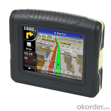

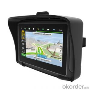
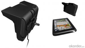
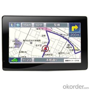
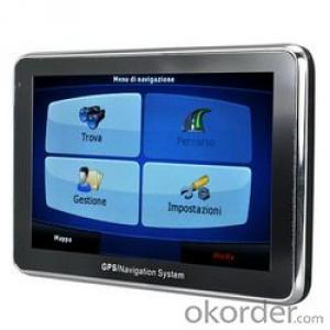
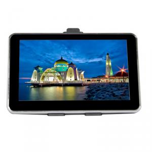
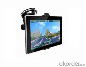
Motorcycle/Water Proof GPS Navigation System
- Ref Price:
-

- Loading Port:
- China main port
- Payment Terms:
- TT or LC
- Min Order Qty:
- 100 set
- Supply Capability:
- 5000 set/month
OKorder Service Pledge
OKorder Financial Service
You Might Also Like


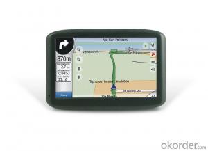
Motorcycle/Water Proof GPS Navigation System
Specification
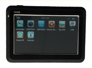
Hardware Waterproof YES (IPX7) CPU Screen Display Resolution Memory Flash ROM RAM GPS Module Antenna Bluetooth Audio Video Photo Input /Output Touch Panel Speaker SD / MMC USB UUT Drop Test(OK) Place a 3mm thickness fireproofing wood block, Power on the UUT, then drop it from 80cm height freeness by front, side and bottom face .NO function problem Buttons / Switches Battery Type Active System continues with backlight setting on middle range & GPS function on full power mode about 3.0(TBD) hrs Charger Car Charger Output Certification & Regulation Environment Conditions Temperature Operation Storage Humidity Operation Storage Performance Physical Key Software Package ContentsSAMSUNG S3C2416 processor400MHz 3.5 inch touch panel, TFT screen,65536 colors 320*240 NAND Flash support 64MB to 8GB 128M DDR2 SDRAM High Sensitivity Receiver (NXP GNS7560) Real built-in antenna (built-in GPS high sensitivity receiver42 channel) Built in MP3/WMA9/WAV WMV,ASF,MOV,MPG JPG、TIFF、PNG Resistive type touch panel Built–in loud speaker TF slot, capacity up to 8GB (support TF HC) USB 2.0 Device (Mini Port) Hardware Power ON/OFF Switch and Reset Switch Built-in 3.7V 1300mAh Li battery Rechargeable battery 5V, 1.5A CE,FCC, RoHS -20~+60°C -20~+80°C 45~80%, Non-Condensed 30~90%, Non-Condensed Hot start<=3sec (in open place,-130dBm) Warm start<=32sec (in open place,-130dBm) Cold start<=38sec (in open place,-130dBm) Satellite reacquisition time accuracy:100ms Position accuracy: <5M ( outdoor , -135dBm ) Crystal-Clear 3-D and 2-D Graphics Dimension: 104 x 88.5 x 23.0 mm Weight: 1kg/pcs Operating System Microsoft Windows® CE NET5.0 Core version 3.5”Unit * 1pc Mini USB cable * 1pc Stylus * 1pc Device Holder * 1pc Cradle: * 1pc User Manual (hardware only)* 1pc Gift box * 1pc

FAQ:
- Q: What can we do for the special customer?
A: Provide custom made service with customer's drawing; We make sure to provide you with the best solutions for your individual case. Whether standard items or non-standard items.
- Q: What can we supply?
A: We provide high levels of communication from start to finish.
- Q: What is our advantage?
A: Top Cemented Carbide has extensive business experience, Fast delivery and high quality.
- Q: Civilian GPS accuracy in 10 meters or so, how to achieve accurate positioning navigation? Is the signal received by the GPS sent by satellite or sent from other places? If it were sent by satellite, what's the difference between the GPS on the car and the handheld GPS? Is it authorized?Please explain!
- 10 meters? Generally 3 to 10 meters, even in the auxiliary road can also show, so don't worry about inaccuracy, car with civilian is a meaning, are satellites, authorized? This... Do you mean to buy genuine goods? There is no need, nor can I buy it.
- Q: Car GPS navigator, which brand is better?
- That is to find a special export brand, and recommend to you "INNVO" this brand, the main export
- Q: I bought a 2 NISSAN Teana, car DVD is converted up (no brand. With GPS navigation,...). Friends DVD's memory card to help download songs, the inside of the mess of documents are deleted, and now the navigation can not be used (there is navigation on the screen, but the press did not react, touch screen). I would like to ask you, what is the program deleted, or deleted the map, if you delete what should I do? Please explain it, thank you!
- Upstairs is correct, ha ha.Careland map folder: NaviOneCityonmap map folder: CJTRoad map folder: RatiYou insert your memory card into your computer to see if there are any map folders in it. No, you need to reinstall it.
- Q: Open navigation interface, there is no map display, there is a satellite, that is, the light shows their own arrows, the other blank
- May be SD card or card software, a problem, the general GPS has a reset hole (reset), first with a pencil like the kind of poke, reset it, try, if not look at instructions.
- Q: Is the new Carnival special navigator, other functions can also be careless, GPS signal reception is poor, sometimes have to wait to receive ten minutes before, hoped the knowledgeable friends can instruct me. Thanks in advance.
- This is the machine is not normal, under normal circumstances, usually in 2 minutes to locate!
- Q: Does vehicle navigation require traffic? Do you need money?
- Not all free upgrades, when the money
Send your message to us
Motorcycle/Water Proof GPS Navigation System
- Ref Price:
-
- Loading Port:
- China main port
- Payment Terms:
- TT or LC
- Min Order Qty:
- 100 set
- Supply Capability:
- 5000 set/month
OKorder Service Pledge
OKorder Financial Service
Similar products

Hot products

Hot Searches
Related keywords

