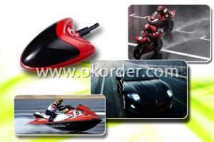
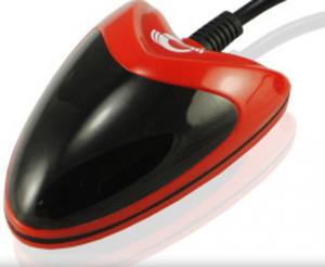
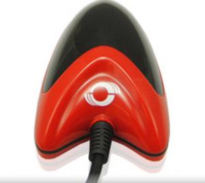
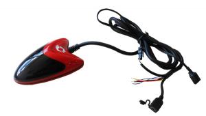

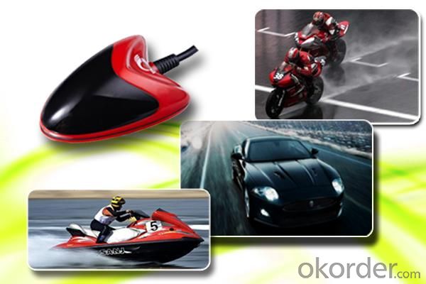

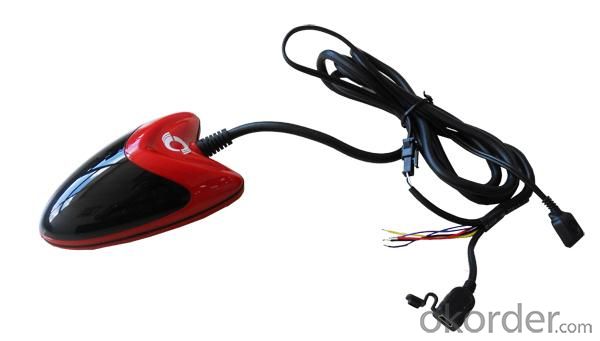
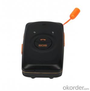
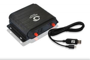
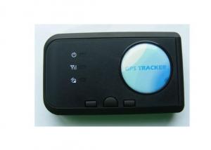
Water-proof Motobike GPS Tracker
- Ref Price:
-

- Loading Port:
- China Main Port
- Payment Terms:
- TT or LC
- Min Order Qty:
- 1 Set unit
- Supply Capability:
- 5000 Sets Per Month unit/month
OKorder Service Pledge
OKorder Financial Service
You Might Also Like


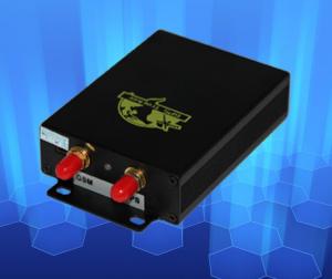
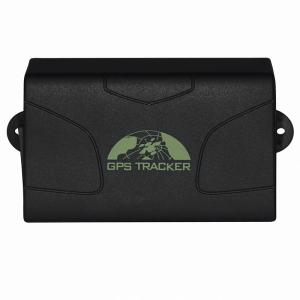
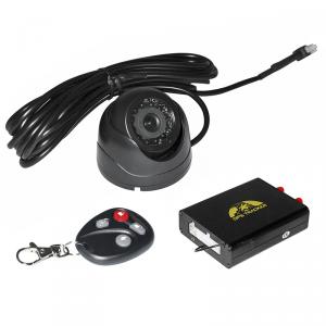
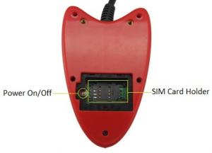
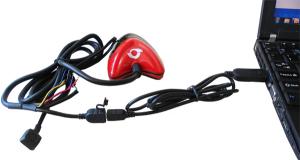
Features of Water-proof Motobike GPS Tracker
|
Smart Design |
|
Looks like one part of your vehicle and motorcycle for concealed installation |
|
Internal GPS and GSM antenna |
|
Waterproof IP66 |
|
Engine Cut |
|
Acc Detection |
|
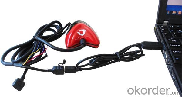
Easy to install without complicated cables |
|
Detect the status of vehicle’s engine and door for anti-theft. |
|
GPS / GSM (LBS) tracking |
|
GPS Logging |
|
Report SMS With Google Maps Link |
|
Not only report latitude and longitude, but also link for quick access to Google maps on your smart phone. |
|
Dual tracking mode helps you track by GSM station while no GPS signal. |
|
Monitor and manage the vehicle by historical report. It can record the data for 6 months by 3 minutes interval. |
|
GPS Blind Spot Alarm |
|
Tow Alarm |
|
Power Cut Alarm |
|
Alarm when there is no GPS signal. |
|
Alarm when the vehicle is towed. |
|
Alarm when the external power is cut. |
|
GPS Tracking System |
|
GPS/GSM (LBS) tracking |
|
I/O status dynamic display |
|
Polygon Geo-fence |
|
Group command-sending |
|
Route deviation alarm |
|
More than 20 language versions |
|
Map: OSM, Google, Bing, MapABC |
|
APP for smart phone |
More Functions of Water-proof Motobike GPS Tracker
|
Tracking |
|
On demand, time interval, distance interval |
|
Alarm |
|
SOS, Geo-fence, GPS blind spot, low battery, speeding, tow, GPS antenna cut, external power cut |
|
Report |
|
alarm, history, speed, parking, sensor, RFID, input, picture |
|
OTA |
|
Upgrade firmware over the air |
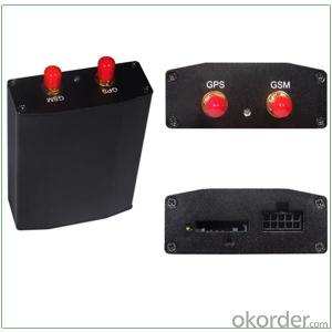
Specifications of Water-proof Motobike GPS Tracker
|
Appearance | |
|
Dimension |
110x72x39mm |
|
Weight |
170g |
|
System | |
|
Charging Voltage |
Mini USB charging interface, DC4.2V~5.5V/400mA |
|
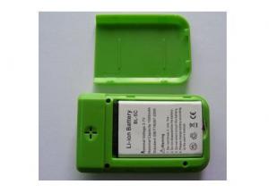
Back-up Battery |
1100mAh/3.7V rechargeable and replaceable lithium-ion battery (NokiaBL-5C compatible) |
|
Power Consumption |
65mA standby current |
|
Operating Temperature |
-20℃~55℃ |
|
Input Voltage |
DC 9V~36V/1.5A |
|
Back-up Battery |
-20°C~55°C |
|
Humidity |
5%~95% |
|
Work Time |
43 hours in power-saving mode and 10 hours in normal mode |
|
LED |
2 LED lights to show GPS, GSM and other status |
|
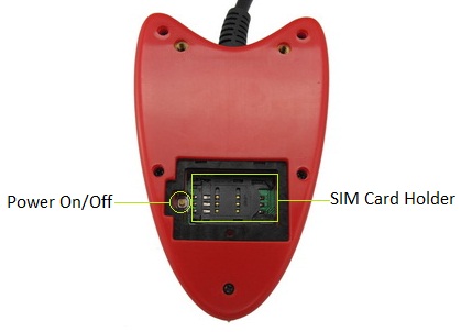
Button |
1 SOS and 1 power on/off |
|
Microphone |
None |
|
Memory |
4M |
|
Sensor |
Motion Sensor |
|
GSM Frequency |
GSM 850/900/1800/1900MHz |
|
GPS Chipset |
SIRF-Star III |
|
GPS Sensitivity |
159dB |
|
Accuracy |
10 meters, 2D RMS |
|
I/O |
2 Digital Inputs (1 negative and 1 positive)1 Analog Input1 Output1 USB port for configuration |
|
Accessories | |
|
USB data cable / User manual / warranty card and CD | |
Tracking platform of Water-proof Motobike GPS Tracker

Certificates of Water-proof Motobike GPS Tracker

Workshop of Water-proof Motobike GPS Tracker

Testing Equipment of Water-proof Motobike GPS Tracker

Shippment of Water-proof Motobike GPS Tracker

- Q: I would like to do the electric car GPS locator manufacturers, where can I buy and install star GPS.
- Never heard of this, I installed an et100 car is rice, but also to see others this installation
- Q: What is the role of the GPS locator GMSAnonymous browsing | 118 times
- 2, GMS certification is very difficult, if through this certification, it shows that the strength of the company's production OK
- Q: Car GPS locator installed in the car where the location is good
- Door partition;Under the trim panel under the windshield;Front bumper, need to pay attention to waterproof;Under the windshield wiper, need to pay attention to waterproof
- Q: Mankiw and strong GPS satellite positioning way which is good
- General GPS terminal (about 400 yuan) + a traffic card (opened a package of $5 a year) + software (see if it is free). Each fee is different, but generally 500 - 600 get.
- Q: Gps locator user name and password
- General equipment factory will produce a number of IMEI, is a long string of numbers as the account posted on the device, directly into the 15 bit device number can be, except the default password is 123456 individual manufacturers
- Q: GPS positioning system on the phone how to use ah?
- You download a mobile phone Google map. That's pretty good
- Q: The simplest and easiest language to say. Do not professional, do not understand......
- So, in order to quickly make satellite positioning to your mobile phone, we use a A-GPS in every time before the need to update and update, "GPS accelerator" "GPS accelerator" on the need to network, is the need to GPRS, there will be traffic, but very few. So A-GPS for GPS is also charged,, A-GPS requires network support in order to achieve fast positioning, if you are a device A-GPS, can also use "GPS accelerator", the direct use of GPS navigation, navigation can be, but the positioning time is very slow, because it does not use the network and common GPS. Or simply speaking, A-GPS is the first GPRS Internet access point: table +GPS receiving satellite navigation signal; and GPS is only by receiving satellite navigation signal to achieve navigation.
- Q: Bad weather will affect the GPS locator accept signal
- Will affect the GPS is based on the above satellite transmission of information, if blocked, the message will be transmitted a little error
- Q: European GPS locator customer service phone
- My device IMEI number forgot? Can you help me find it
- Q: How to locate the car car
- First, buy a satellite on the Internet to install the car, you can use a mobile phone or computer to locate the car,
1. Manufacturer Overview
| Location | Guangdong,China |
| Year Established | 2002 |
| Annual Output Value | Above US$100 Million |
| Main Markets | Latin America Western Europ Southeast Asia |
| Company Certifications | CE;FCC |
2. Manufacturer Certificates
| a) Certification Name | |
| Range | |
| Reference | |
| Validity Period |
3. Manufacturer Capability
| a) Trade Capacity | |
| Nearest Port | Shenzhen |
| Export Percentage | 71% - 80% |
| No.of Employees in Trade Department | 100-500People |
| Language Spoken: | English, Chinese, Spanish, Portuguese, Korean |
| b) Factory Information | |
| Factory Size: | Above 50,000 square meters |
| No. of Production Lines | Above 10 |
| Contract Manufacturing | OEM Service Offered Design Service Offered Buyer Label Offered |
| Product Price Range | High;Average |
Send your message to us
Water-proof Motobike GPS Tracker
- Ref Price:
-
- Loading Port:
- China Main Port
- Payment Terms:
- TT or LC
- Min Order Qty:
- 1 Set unit
- Supply Capability:
- 5000 Sets Per Month unit/month
OKorder Service Pledge
OKorder Financial Service
Similar products
Hot products


Hot Searches
Related keywords

