


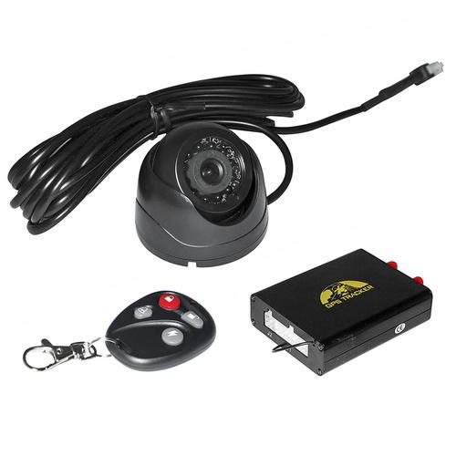

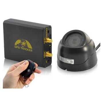

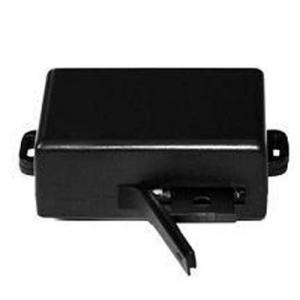
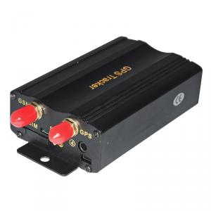
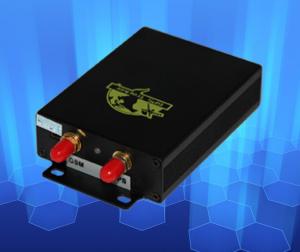
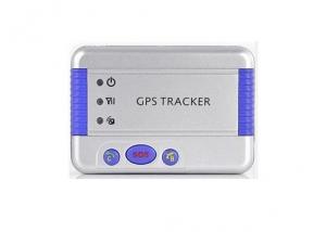
GPS Vehicle Tracker 106
- Ref Price:
-

- Loading Port:
- China Main Port
- Payment Terms:
- TT OR LC
- Min Order Qty:
- -
- Supply Capability:
- -
OKorder Service Pledge
OKorder Financial Service
You Might Also Like


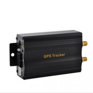
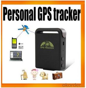
GPS Tracker,which set multiple functions of accurately positioning,security, monitoring surveillance, emergency alarms and tracking in its entirety,special for vehicle.
The product fully supports the functions of SMS / GPRS / Internet data transmission,to make it more widely used in large-scale monitoring, emergency scheduling, location-based services, traffic safety and many other areas of management.
Detailed description:
It is based on GSM/GPRS(850/900/1800/1900MHZ)wireless telecommunication internet and GPS satillite global position system,track by several ways.provide monitor software and global map.real-time track through the monitor software in your pc;track through your PDA cell phone and googleearth.
Features and functions
Authorization
Modes switch “track”, “monitor”
Single Locating
Auto track continuously
Automatic update positions of vehicle turns
GPS drift suppression
Absolute street address by SMS
Location based service (LBS)
View photos on cell phone
Data logging
Auto logging
Logging upon times
Multi-logging
Logging Clearance
Data Load
Forward the third parties’ message
Charges Inquiry
ACC working alarm
Remote Controller (Optional)
Program the Remote Controller
Setting for Button SOS/Remote Start Function
Switch between Electric and Vapor lock
Silent Mode
ARM / LOCK ( All the functions of Lock and Unlock must work with the optional relay box of central locking system)
ARM / LOCK BY SMS
ARM / LOCK by Remote controller
Disarm
Disarm by SMS
Disarm by Remote Controller
Alarm Pause
Find Vehicle via Remote Controller
Remote Boot Release
Alerts Function
SOS Emergency Alarm
Geo-fence
Multi-area management
Movement Alarm
Over Speed Alarm
Fuel Checking Alerts (Optional)
Temperature Checking Alerts (Optional)
Low battery alarm
Power off alarm
GPS Blind Spot Alert
Accident Alarm (Optional)
Alarms under Arm State
Door Open Alarm
Bonnet alerts
Footbrake Alarm
Acc Alarm
Shock Sensor Alarm (Option)
Auto Photograph (Option)
Alarms in GSM Blind Area
Trigger Memory
No GSM Alarm
Cut off oil and power system
Resume the Oil and Power System
Auto-arming
Door closing remind
Park warning
Automatic Central Locking System
Setup Appointment (Option)
Car Type Setting
Operations of MT Vehicle setup appointment
Appointment Fail
Cancel startup appointment
Start/turn off car remotely
Empty / Loaded
Check the Vehicle State
Reset by SMS
Sleep ModeCheck
Terminal (local) Time Setting 28
TCP/UDP switch
Configure parameters by USB
GPRS Setting
Less GPRS traffic
Modes Switch between “SMS” and “GPRS”
Set up monitor center number
- Q: What does GPS mean
- GPS principle24 GPS satellites orbiting the earth at an altitude of about 12 thousand kilometers from the ground, making it possible to observe more than 4 satellites at any point on the ground at any time, at any point in the.That due to the precise position of the satellite in the GPS observations, we can get the satellite to the receiver distance, the distance formula of three-dimensional coordinates, using 3 satellites, can be composed of 3 equations, solved observation point (X, Y, Z). Considering the error between the satellite clock and receiver clock, in fact there are 4 unknowns, X, Y, Z and clock, which requires the introduction of fourth satellites, the formation of 4 equations to solve, in order to get the observation points of latitude and longitude and elevation.In fact, the receiver can often be locked more than 4 satellites, then the receiver according to the distribution of the satellite constellation is divided into several groups, each group had 4 teeth, and then through the algorithm selected a set of minimum error for positioning, so as to improve the accuracy of.Due to the orbit of the satellite, the satellite clock error, the impact of the atmospheric troposphere and ionosphere on the signal, as well as the artificial SA protection policy, the positioning accuracy of civil GPS is only 100 meters. In order to improve the positioning accuracy, commonly used differential GPS (DGPS) technology, the establishment of base station (differential Taiwan) were observed in GPS, using the known exact coordinates of the base station, compared with the observed values, so that a number of amendments, and released. After receiving the correction, the receiver compares with the observed values, eliminates most of the errors, and obtains a more accurate position. The experimental results show that the positioning accuracy can be increased to 5 meters by using differential GPS.
- Q: I heard that the quality GPS locator are similar positioning scheme are the same, Guan Jian in the service platform, our company is doing a good logistics please imagine. Thank you
- Star Connaught hi tech in the country are very well-known, hope to adopt!
- Q: For a free installation of GPS car locator?
- In addition to the pre installed G book or Jetion car really want to install a GPS car locator to receive a total transmitter GPS bar
- Q: the battery can be replaced, frost resistance, waterproof, when the horses mobile phone can receive text messages over speeding horsesIt is best to wear a belt, worn on the neck of the livestock is convenient, not easy to fall, similar to the release of the northeast tiger Putin that is the best
- 2, the platform function of the two trajectory query (trajectory query, track playback):Trajectory query: automatic recording and can be used to query the historical trajectory. Design the best route. Describe the name, location time and location information of the person or vehicleTrack playback: according to the time, the dynamic playback of the real trajectory, the action line at a glance, support for trajectory download.Automatic playback of a historical track, check personnel and vehicle trajectories in a period of time, a route optimization analysis for managers and employees of collective, summarize the successes and failures, and improve the strength and efficiency of the whole team.
- Q: How to open the iPad location service
- First, I want to explain to the home with the non 3G version of the iPadGPS positioning A-GPS positioning base station Wi-Fi line hot spot I want to play WiFi to join WiFi
- Q: Mobile GPS positioning charges it?
- This is no charge, GPRS is a satellite positioning system. But with the phone, it will produce a certain amount of traffic, but not much.
- Q: How to find mobile phone GpS satellite positioning car
- The fourth step: terminal fixedGPS positioner has the advantages of small volume, easy to install hidden. Common fixed position is the main driving / sub driving front baffle removed, in its internal space, as well as seat underground, trunk, etc. can also be installed. On the one hand to ensure that the GPS antenna can receive satellite signals, but also to ensure that the vehicle when the car is not easy to wash water and lead to the end of the burning.The fifth step: activate the lineAll the above steps are completed, the vehicle will recover. Then the license plate number, terminal ID, SIM card number and other information reported to the company's customer service staff to activate, so in the computer and mobile phones, WeChat can be positioned on the vehicle management.I hope this answer is helpful to you
- Q: What are the advantages of children's GPS smart positioning watch?
- According to Baidu search shows that every year there are 3330000 children lost due to various reasons, such a huge number, shocking! The child is lost every family tragedy, you may have thought that by some intelligent devices, the mobile phone with your child "bound", like satellite positioning, and let the two always emerge in the eyes of parents? This is the true meaning of the lost watch.What kind of anti - lost watch is suitable for children to use it? First, this anti lost watch must have the ability to prevent loss, need to locate the system through the GPS, always lock the phone and the exact location of the wearer. Secondly, the child is a parent's heart meat, parents are more likely to be able to know their children's learning situation, living conditions and safety.To this end, Jiangxi Mobile Co., Ltd. for the launch of the smart positioning products - positioning for my children watch. GPS+ base station +WIFI three re positioning, in the custody of children's health and safety at the same time, so that parents can know the child's life information anytime, anywhere.
- Q: Function and application of GPS locator
- (four) 1 in order to avoid the installation of equipment failure, one should try to avoid hidden; 2 and the emission source together, such as wireless burglar alarm, reversing radar, car and other communications equipment; 3 can be used to tie fixed, or wide sponge strong double-sided adhesive paste; 4 GSM antenna device and the GPS antenna should be installed to ensure the positive upward (sky). Bu implied condition GPS module SiRFStarIII to accept every two output position data, usually $GPRMC to streamline the data format, including latitude, longitude, speed (nodes), motion direction angle, year, month, minutes, seconds, milliseconds, positioning data is valid or invalid, and other important information. The statement is as follows: $GPRMC,,,,
- Q: Method of use of GPS
- 2 no map use. 1) the use of road point: commonly used to determine the coordinates, to determine the rock caves as starting point, line or other coordinates, the coordinates of the point of turning. Easy to use, MARK a coordinate on the line. Find a point: to find the location must have to sign (landmark/waypoint) exists in the form of GPS in the memory, you can MARK or from previously visited a friend to get data, manual / computer into sign data upload. Press the GOTO key to select your destination from the list, and then go to the "guide" page, which will show you away from the target distance, speed, direction of the target angle and other data, according to the direction angle can be. 2) use the route input route: if you can find the route information recorded by the previous friends, type them into the GPS to form a line, or (usually return to the original road) to edit the previously recorded road sign into a line. Route guidance: put a route according to the activation, and looking for "the same way," guidance "page will lead you to the first point, the route once arrived, the target will automatically replace the next road," guidance "page to lead you to the line of second points if you deviate from... The route over some intermediate point, once you go back to the line," targeting "you will skip around those points, for your current position corresponding to the next point on the line. 3) backtracking is actually a special method of input line (route), it is very easy to return to the original path.
Send your message to us
GPS Vehicle Tracker 106
- Ref Price:
-
- Loading Port:
- China Main Port
- Payment Terms:
- TT OR LC
- Min Order Qty:
- -
- Supply Capability:
- -
OKorder Service Pledge
OKorder Financial Service
Similar products


Hot products


Hot Searches
Related keywords

