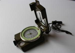


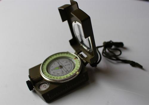


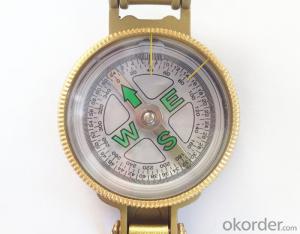
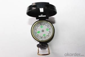
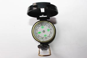
Portable Army or military compass in aluminium material
- Ref Price:
-

- Loading Port:
- China Main Port
- Payment Terms:
- TT OR LC
- Min Order Qty:
- -
- Supply Capability:
- -
OKorder Service Pledge
OKorder Financial Service
You Might Also Like


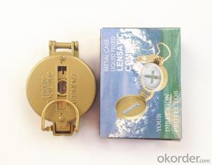
Specifications
Model: DC60-2A
Name: outdoor hiking or military compass and army compass, metal compass and marching compass in aluminium material
Product Origin: China
Supply Ability: 40,000 pcs/month
Minimum Order: 100 pcs
MOQ for OEM package: 500pcs
Detailed Product Description
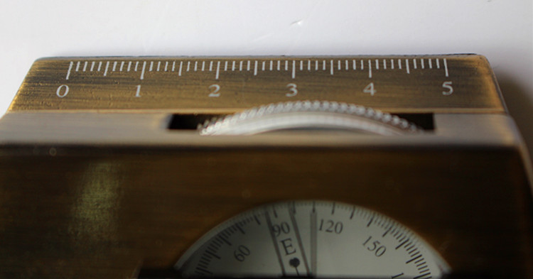
Product Size: 85*53*30 (mm)
Color: Army Green, Military green, Black
Material: Aluminum alloy
Features:
1)Can easily folds to fit in your pocket
2) The compass is highly accurate and features a liquid-damped compass card with a luminous dial that can easily be read at night, and a standard bezel with two yellow lines at 45 degree angles
3) The compass card has both the standard 0 - 360 degree scale, as well as the 0 - 64Mil scale (one yard at 1,000 yards)
4) The bezel rotates with detents every 3 degrees so you can change the heading reference a known amount without looking at the compass
5) The front sight has a magnifier to simultaneously view the magnetic heading when taking a sight
6) A second magnifier assists in reading the magnetic heading when direct viewing from above
7) When unfolded flat, the marching compass has a straight edge with a standard 1:25,000 or 1:50000 map scale
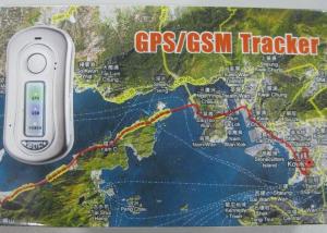
- Q: Locator installed in someone else's car on the law
- Does not constitute a crime. Civil tort only.
- Q: How to track vehicle location
- GPS is that there is a feature that can call or internet access at any time to check the location of their car, but have to spend money ah.
- Q: TenI want to buy a GPS locator installed in my husband's car, always do not go home, do not know what he was doing outside!
- Locator is not so easy to install and need to connect the power, put on the car your husband will know. If he parked in the company, and then take a taxi to go out to play locator is not useless. There are many ways to know his position, but the proposal is to trust each other, the occurrence of the total will occur, locator can not solve the problem.
- Q: Chengdu GPS locator installed there
- Wuhou Avenue has a DDTxzx02 price quality effect is also ideal site
- Q: UU vehicle GPS locator convenient?
- UU car locator free installation, strong magnetic adsorption, large capacity battery, long standby.
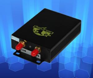
- Q: Can not be installed on the dog like a car on the location of the GPS Dongdong?
- The chip implanted into the dog's skin has no effect on the health of the dog, and has the function of "electronic identity card", once lost, it is easy to find the owner. The life of the electronic chip in more than 20 years, can be accompanied by dogs for life.
- Q: GPS locator can hear the sound?
- Kankes's strong brand Tr03, GT600, Gt500 can listen to Oh
- Q: Does UUGPS have an anti - rejection tracking locator?
- In other words, the city of Shenzhen science and Technology Industrial Co., Ltd. production are good
- Q: Model: Transit strong ET100Fault description: buy to use less than half a year, the last 2 months has been dropping, at first I thought it was a bad signal did not care, by the beginning of a line a few minutes to a few hours, and then to now is the last connection in August 20th, has dropped for 12 days, I went to search not rib. To the star, or the SIM card arrears, another card is also suitable for this kind of situation, dropped call GPS phone tip off. For the cause of the fault analysis and solutions, I think most of the machine is a problem, it is understood that maintenance?
- A line is not good, bad contact, two machines have problems,
- Q: Millet 2 how to turn on or off the tracking positioning system.
- Please enter the settings - all settings - location services, open the GPS positioning service to locate the phone.
Send your message to us
Portable Army or military compass in aluminium material
- Ref Price:
-
- Loading Port:
- China Main Port
- Payment Terms:
- TT OR LC
- Min Order Qty:
- -
- Supply Capability:
- -
OKorder Service Pledge
OKorder Financial Service
Similar products

Hot products
Hot Searches

