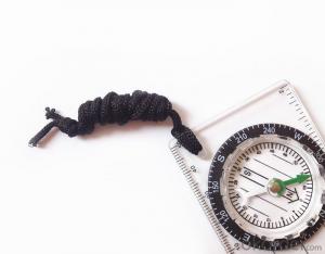


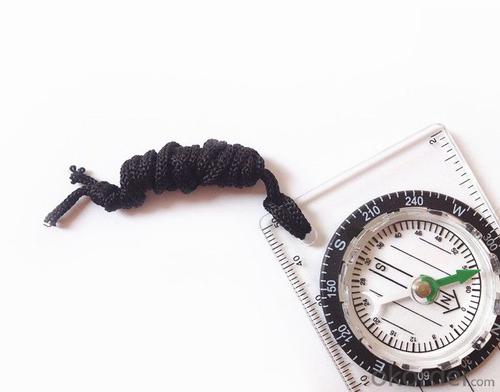


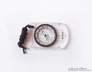
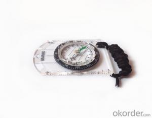
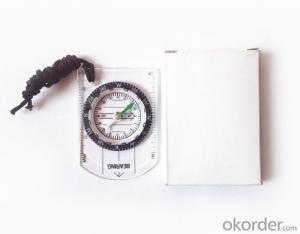
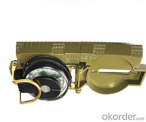
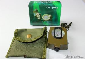
Mapping Mini Compass with Different Scales
- Ref Price:
-

- Loading Port:
- Tianjin
- Payment Terms:
- TT OR LC
- Min Order Qty:
- 50 pc
- Supply Capability:
- 5000 pc/month
OKorder Service Pledge
OKorder Financial Service
You Might Also Like


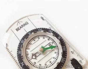
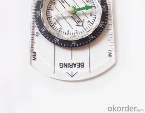
Model: Compass DC35-1B
Name: Professional map compass, ruler compass
Product Origin: China
Supply Ability: 10,000 pcs/month
Minimum Order: 50 pcs
MOQ for OEM package: 500pcs
Product Size: 70*48*9 (mm)
Features of Compass DC35-1B:
1, professional usage: orientation, distance measuring, measuring slope, azimuth and pitching Angle measurement, drawing, a magnifying glass
2, high quality compass with neck rope, portable and rugged
3, ACRYLIC material, about 2mm thick
4, Damping Dial: to keep the stability of the pointer, more suitable for outdoor
environment.
5, Accuracy: accurate and clear, there were 360 degrees azimuth Angle, outer ring is 64-00 system, Liquid filled in the compass for reliable readings.
6, Magnifier function
5, with ruler on compass DC35-1B,
6,for map measure and drawing
7,one meter neck rope,
8,Liquid filled in the compass for reliable readings,
9,Magnifier function.
10,Support OEM

- Q: Do I have to have a flow or a phone card? How much is the cost? The most simple, only positioning it?To know how to explain. What is the core of GPS positioning? Mobile phone signal flow or signal? Or a single chip?
- The core is the GPS chip, the phone receives the satellite signal through the calculation of the chip to get your position, you can not flow.There is a AGPS technology, you can first use the mobile base stations to determine the approximate location, and then through the analysis of the signal receiving chip to which satellite positioning, this way more quickly, but want to consume a little data flow.
- Q: Portable navigator download software, how to delete it
- Therefore, it is not recommended to download their own software, or with a professional navigator it, well-known brands, and so on
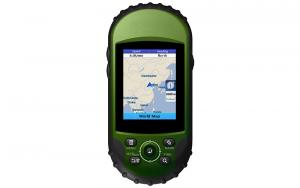
- Q: These two days on the Internet scouring a block of mobile phones, with GPS. Give it a navigation map, loaded with several. Such a question today. What is the difference between the GPS module and the handheld GPS accuracy? Can you use the phone's GPS instead of a handheld?
- The main function of the map is on the phone, GPS accuracy is higher, but in the fog and haze weather accuracy is reduced
- Q: Portable navigator remove the built-in battery, powered by cigarette lighter, there can not be star search, enter the navigation page after the card or crash, sometimes the screen image is not steady, car is not good, what is going on, how to solve? After a 12V to 36V wide voltage charger or the like
- Hello, what kind of, send a picture to me. I am glad to answer for you, there are questions to ask oh, your support is my greatest encouragement. I wish you a pleasant car.
- Q: How to install the navigation map of a portable navigator in a truck to a Android phone
- Why don't you just download a navigator ah, I use the Tencent road treasure, said in the Internet so a word, Tencent road treasure, for driving!I use, very practical! On the one hand, he can be used as a simple navigation to show you the direction, on the other hand, can give you a clear route.. Now the traffic jam situation is very serious, software in some big cities every half a minute to update the real-time road conditions, to ensure that the driving route is perfect without clogging. There are other uses, I do not say, or the whole of me as if to sell.. Dig yourself ohI hope my answer can help you
- Q: Why portable navigator must insert card
- Because the card has a map software, if there is no card can not run the map, so there will be no navigation significance.
- Q: Portable navigation interface into a desktop computer how to restore
- Drivers in the driving process should try to avoid the operation of the E road navigation system, so as not to distract attention to security issues. Prior to the completion of the E road navigation system or by the passengers to operate in order to protect the driver, passengers and other people's safety first. Due to the continuous upgrading of the product, the actual operation steps may be inconsistent with this manual, please use the actual operation.
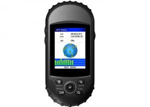
- Q: How to use GPS portable terminal SOS
- At this time the background can be opened immediately monitoring to confirm the alarm signal authenticity, in the installation of a real-time camera can immediately open the camera to see the conditions surrounding equipment, is to determine if the emergency immediately call the police,
- Q: Portable GPS navigation machine with a backing image
- Support reverse image navigation, reverse video input interface of the machine with special, need to install the camera in the car, and the connecting line, finally the reverse video input interface is connected with the line access navigator on it, if reversing camera and reverse gear linkage to automatically open, also need to take a reversing signal line for detecting reverse gear state, usually can be connected to the reversing light, when reversing light, automatically reversing camera navigator, and displays images on a screen
- Q: How to update the car or portable GPS map navigation
- There are two categories: first, there is the SD card navigation, you can upgrade, through the Internet, download free toll navigation map, requires a little technical capacity. You can also spend a little money in the roadside car and a variety of car loading shop upgrade.
Send your message to us
Mapping Mini Compass with Different Scales
- Ref Price:
-
- Loading Port:
- Tianjin
- Payment Terms:
- TT OR LC
- Min Order Qty:
- 50 pc
- Supply Capability:
- 5000 pc/month
OKorder Service Pledge
OKorder Financial Service
Similar products

Hot products
Hot Searches

