

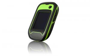
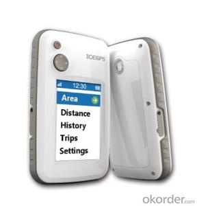
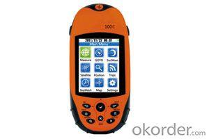
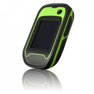
Portable GPS C2
- Ref Price:
-

- Loading Port:
- China Main Port
- Payment Terms:
- TT OR LC
- Min Order Qty:
- -
- Supply Capability:
- -
OKorder Service Pledge
OKorder Financial Service
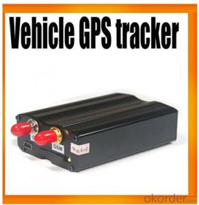
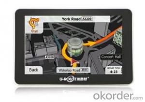
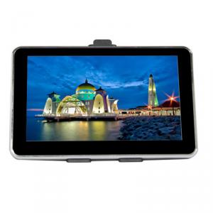
You Might Also Like


Applications :
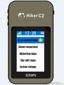
The new GPS touch screen test through Mu instrument with area measurement, distance measurement, positioning function, achieve walking map, can be set up to automatically save the measurement parameters, record, at the same time, can navigate to the start of measuring block.
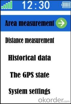
Area measurement
A key measure of farmland, forest land area, can save 64 results and real time display field shape
Linear range
Calibration of the beginning and the end, measuring the distance between any two points a straight line
Historical data
To view detailed information on the measuring record, navigation users find the measurement plots starting position
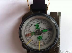
The GPS state
You can view the coordinates, altitude, heading, accuracy and provide positioning state, the astronomical information
System settings
Set the product related parameters (for example: unit, unit price)
- Q: Portable navigator can not boot, how to solve? Click on the screen does not respond.
- The memory card format is no problem (I can not think of any good way).
- Q: Kelid version number c0677-c5109-0931ZF4, how to upgrade?I am a portable navigator, 4.3 inch screen, CE5 system, 2G storage. Kelid version number c0677-c5109-0931ZF4, now the map has expired, how can I upgrade it?My email address is If possible, please let me know
- My portable navigation machine 2G storage, can be connected to the TF memory card, the original Kelid is stored in the 2G machine, with external memory card on it?
- Q: What is the difference between a portable navigator and an integrated navigation system? Seems to function almost, but the price difference is huge ah
- I see a lot of portable navigation is directly in the center of the corner to find a support point. One machine, then we have a lot of reform. There are relatively high cost. I don't know if I can help you
- Q: Journey portable navigation zt790 map upgrade what port
- The conqueror's official websiteCorresponding model download dataUpgradeYou don't need a port
- Q: How to display portable navigator
- Sucker suction on the windshield before you can ah,However, it is recommended to close to the central console, so that even if the bumpy road is not easy to fall off,
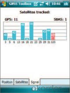
- Q: I just bought 20 minutes of navigation can not find the stars! What is the reason?
- Estimation is a problemUnder normal circumstances, open the navigation software, 30 seconds to search for the satellite, the general is the beginning of the 2.3 satellites1 minutes or so, you can search for 9--11
- Q: Good navigation with a mobile phone or buy a portable navigator
- For example, you can use the Internet to provide mobile phone navigation road live, can provide more detailed geographic information, it is more convenient to update, you can provide in addition to driving other riding, walking navigation function, can make use of the map will provide the city bus, subway, bus and railway and other information, these are the vehicle navigation not, at least not yet provided.
- Q: How to use handheld GPS locator
- Now the accuracy can reach 30 cm. The latitude and longitude of the WGS84 coordinates.
- Q: Portable GPS navigation how to use?
- There should be a detailed answer to the fact that the site is set to start navigation, but the first point to wait for GPS to determine your current location
- Q: Portable navigation built-in hard disk or a good memory card
- Of course, the built-in hard disk, the built-in hard disk read faster than the memory card
Send your message to us
Portable GPS C2
- Ref Price:
-
- Loading Port:
- China Main Port
- Payment Terms:
- TT OR LC
- Min Order Qty:
- -
- Supply Capability:
- -
OKorder Service Pledge
OKorder Financial Service
Similar products
Hot products
Hot Searches
Related keywords

