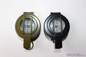


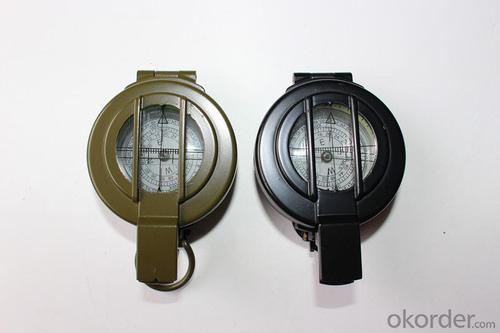


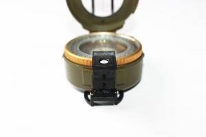
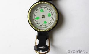
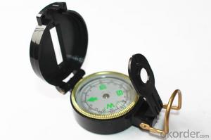
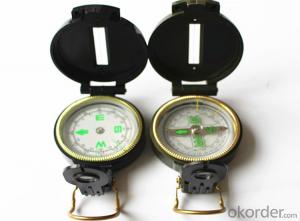
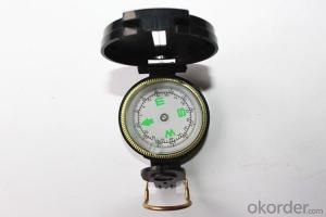
Army and Military Direction Compass For Outdoor Users
- Ref Price:
-

- Loading Port:
- China Main Port
- Payment Terms:
- TT OR LC
- Min Order Qty:
- -
- Supply Capability:
- -
OKorder Service Pledge
OKorder Financial Service
You Might Also Like


Specifications
Model: DC60-1B
Name: outdoor hiking or military compass and army compass, metal compass and marching compass in aluminium material
Product Origin: China
Supply Ability: 40,000 pcs/month
Minimum Order: 100 pcs
MOQ for OEM package: 500pcs
Color: Army Green, Military green, Black
Material: Zinc alloy, stalinite
Features:
1)Can easily folds to fit in your pocket
2) The compass is highly accurate and features a liquid-damped compass card with a luminous dial that can easily be read at night, and a standard bezel with two yellow lines at 45 degree angles
3) The compass card has both the standard 0 - 360 degree scale, as well as the 0 - 64Mil scale (one yard at 1,000 yards)
4) The bezel rotates with detents every 3 degrees so you can change the heading reference a known amount without looking at the compass
5) The front sight has a magnifier to simultaneously view the magnetic heading when taking a sight
6) A second magnifier assists in reading the magnetic heading when direct viewing from above
7) When unfolded flat, the marching compass has a straight edge with a standard 1:25,000 or 1:50000 map scale
- Q: I heard that the function is the most complete, you can listen to it? Many function
- Since it is the most complete function, it must be able to monitor, I just looked at their website, you can also see
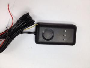
- Q: What are the features of the GPS car locator
- 2 remote tracking and monitoring center in the monitoring software on the GPS terminal timing tracking settings can be set to a fixed time to upload location information and status information, once set up, GPS terminal will according to the monitoring center issued the instruction request timely upload needed information monitoring center;
- Q: How can we know that the car is not installed GPS positioning system?
- More than and 10 of the 200 thousand does not come, only the installation, if there is no radio on the installation of GPS
- Q: IPhone how to turn off GPS
- Find Apple interface settings menu. Find privacy options.Options have privacy options. Locate service on or off.Click on [off] location can be.
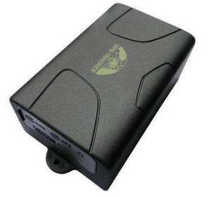
- Q: What kind of GPS positioner needs to be installed for motorcycle
- Goods than three Like GPS terminal (about 400 yuan) + Zhang traffic card (through the flow package of $5) + software (see free) for each fee with the same 500 - 600
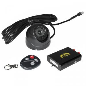
- Q: What kind of GPS locator meets the needs of the car loan industry?
- Wired and wireless combined with the best, wired real-time positioning to understand the trend of the car, looking for a wireless car is the key. Rice gm06 and gm08b together, the only choice
- Q: Samsung mobile g7106 navigation GPS positioning slow what reason
- Dear Samsung users hello:According to your description, GPS can not be determined by many factors, the most important factor is the signal and motion state. In places where satellite signals are poor (e.g., indoor, tunnel, and high rise buildings, etc.), or in a state of motion, GPS is often difficult to locate. Your suggestion:1 use the GPS in an open space and position it as far as possible in a static state (about 5 minutes), and then try to use it in a state of motion.2 if the phone supports A-GPS function, it is recommended to open the function. Method: Set - (more / more general) - Positioning Service - using wireless network - hook (open A-GPS will consume traffic).3 try to replace other location.If the operation after the mobile phone is still not GPS, recommend that you purchase invoice, warranty card and carry it to the Samsung Service Center view.
- Q: How to solve the GPS locator arrears
- Contact you to buy gps suppliers to pay the deposit can be
- Q: What is the meaning of the GPS locator LBS?
- LBS is a location based service, it is through the mobile telecommunications operators of radio communication networks (such as GSM network, CDMA network) or external positioning (such as GPS) to obtain location information of a mobile terminal user (or geographic coordinates, geodetic coordinates), geographic information system (abbreviation: GIS language, English name: Geographic InformationSystem) platform, a value-added service to provide the corresponding service for the user.
- Q: Method of use of GPS
- 2 no map use. 1) the use of road point: commonly used to determine the coordinates, to determine the rock caves as starting point, line or other coordinates, the coordinates of the point of turning. Easy to use, MARK a coordinate on the line. Find a point: to find the location must have to sign (landmark/waypoint) exists in the form of GPS in the memory, you can MARK or from previously visited a friend to get data, manual / computer into sign data upload. Press the GOTO key to select your destination from the list, and then go to the "guide" page, which will show you away from the target distance, speed, direction of the target angle and other data, according to the direction angle can be. 2) use the route input route: if you can find the route information recorded by the previous friends, type them into the GPS to form a line, or (usually return to the original road) to edit the previously recorded road sign into a line. Route guidance: put a route according to the activation, and looking for "the same way," guidance "page will lead you to the first point, the route once arrived, the target will automatically replace the next road," guidance "page to lead you to the line of second points if you deviate from... The route over some intermediate point, once you go back to the line," targeting "you will skip around those points, for your current position corresponding to the next point on the line. 3) backtracking is actually a special method of input line (route), it is very easy to return to the original path.
Send your message to us
Army and Military Direction Compass For Outdoor Users
- Ref Price:
-
- Loading Port:
- China Main Port
- Payment Terms:
- TT OR LC
- Min Order Qty:
- -
- Supply Capability:
- -
OKorder Service Pledge
OKorder Financial Service
Similar products
Hot products


Hot Searches

