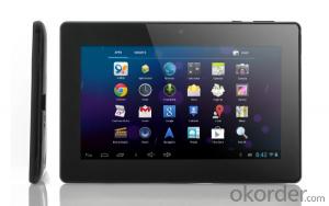


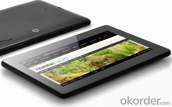
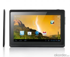
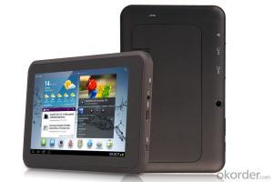
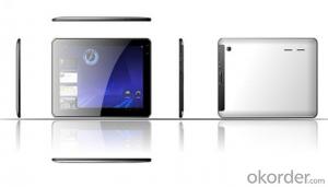
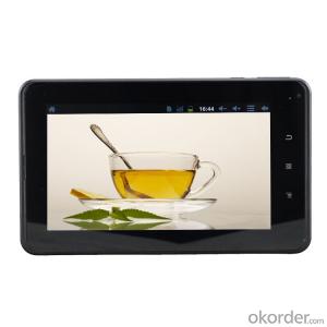
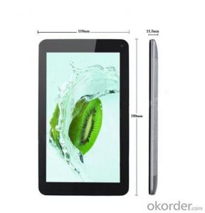
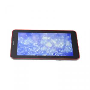
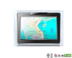
Seven inch Tablet L517
- Ref Price:
-

- Loading Port:
- China Main Port
- Payment Terms:
- TT OR LC
- Min Order Qty:
- -
- Supply Capability:
- -
OKorder Service Pledge
Quality Product, Order Online Tracking, Timely Delivery
OKorder Financial Service
Credit Rating, Credit Services, Credit Purchasing
You Might Also Like
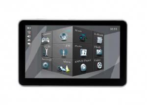

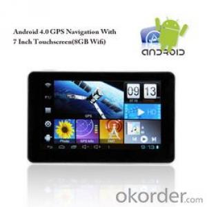
| CPU | Rockchip 3066 Dual Core 1.8GHz, Mali-400 MP*4 Core GPU | |
| Display | 7" TFT qHD 1024*600 (16:9) | |
| Touch panel | Capacitive Touch Panel | |
| System Memory | RAM | 1GB DDR3 |
| Storage | 8GB Nand Flash | |
| External Storage | Support TF card (maximum 32GB) | |
| O.S. | Google Andriod 4.1 | |
| Speaker | D Class | |
| G-sensor | Support | |
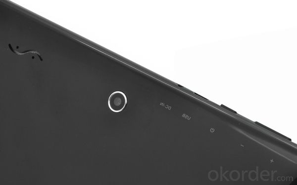
| Camera | Dual cameras.Front 0.3MP, back 2.0MP | |
| Wifi | 802.11b/g/n (high sensitivity) | |
| 3G | External USB 3G dongle | |
| HDMI | Yes (Dual display) | |
| Bluetooth | Optional | |
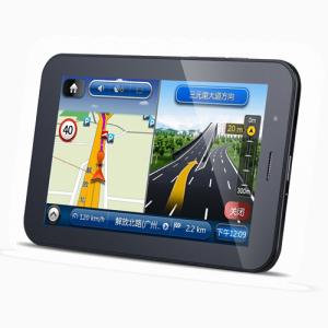
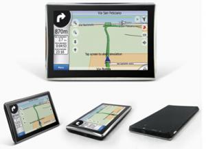
| GPS | Support Google Map,no gps navigation | |
| I/O Ports | 1*USB2.0 port,1* DC Jack,1*HDMI port,1*TF card slot,1*Earphone port | |
| Power | Battery | 3000mAh |
| DC | 5V/2A | |
| Multimedia | Video Format | H.264,VP8,RV,WMV,AVS,H.263,MPEG4 etc1080P,YouTube,720P,HTML5,Flash10.3,Support all video formats |
| Image Format | JPG/BMP/GIF/PNG | |
| Audio Format | MP3,WMA,OGG,AAC,M4A,MA4,FLAC,APE,3GP,WAV | |
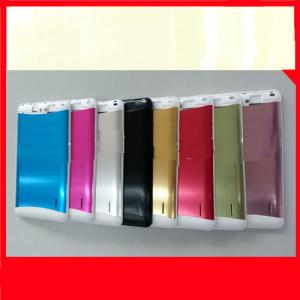
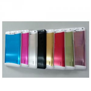
| Color | Black | |
| Product Size | 190*115*9.8 mm | |
| Weight | 280g (720g G.W) | |
| Standard | 1. AC Adaptor 2. USB Cable 3. Manual 4.Box | |
| Optional (extra cost) | Leather case, leather keyboard, USB 3G dongle | |
- Q: Civilian GPS accuracy in 10 meters or so, how to achieve accurate positioning navigation? Is the signal received by the GPS sent by satellite or sent from other places? If it were sent by satellite, what's the difference between the GPS on the car and the handheld GPS? Is it authorized?Please explain!
- 10 meters? Generally 3 to 10 meters, even in the auxiliary road can also show, so don't worry about inaccuracy, car with civilian is a meaning, are satellites, authorized? This... Do you mean to buy genuine goods? There is no need, nor can I buy it.
- Q: Car GPS navigator, which brand is better?
- That is to find a special export brand, and recommend to you "INNVO" this brand, the main export
- Q: I bought a 2 NISSAN Teana, car DVD is converted up (no brand. With GPS navigation,...). Friends DVD's memory card to help download songs, the inside of the mess of documents are deleted, and now the navigation can not be used (there is navigation on the screen, but the press did not react, touch screen). I would like to ask you, what is the program deleted, or deleted the map, if you delete what should I do? Please explain it, thank you!
- Your friend has deleted your navigation software, and in this case you need to go back to the corresponding site to download the map again. You can go to buy your navigation there to install, general loading map, you can also search the Internet, but you want to understand your car navigation port and baud rate, as well as resolution, these can download the corresponding map. But the best advice is to download it from the site you purchased. It's so convenient and quick.
- Q: Open navigation interface, there is no map display, there is a satellite, that is, the light shows their own arrows, the other blank
- Did you enlarge the map?
- Q: Is the new Carnival special navigator, other functions can also be careless, GPS signal reception is poor, sometimes have to wait to receive ten minutes before, hoped the knowledgeable friends can instruct me. Thanks in advance.
- This is the machine is not normal, under normal circumstances, usually in 2 minutes to locate!
- Q: Does vehicle navigation require traffic? Do you need money?
- First, any car navigator is directly connected with the satellite, without the network, so it does not need traffic.Two, car GPS has two kinds, one is the navigation, navigation is one way to receive signals with good software has been downloaded in the instrument map is displayed, because have downloaded a good map so not networking, so as not to need to flow.One is GPS monitoring, the Y is two-way, not only receive, but also automatically send location information to the background software, to use the network, so you need traffic card support.
Send your message to us
Seven inch Tablet L517
- Ref Price:
-
- Loading Port:
- China Main Port
- Payment Terms:
- TT OR LC
- Min Order Qty:
- -
- Supply Capability:
- -
OKorder Service Pledge
Quality Product, Order Online Tracking, Timely Delivery
OKorder Financial Service
Credit Rating, Credit Services, Credit Purchasing
Similar products
Hot products
Hot Searches
Related keywords

