
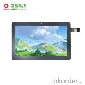
Professional GIS K200
- Ref Price:
-

- Loading Port:
- China Main Port
- Payment Terms:
- TT OR LC
- Min Order Qty:
- -
- Supply Capability:
- -
OKorder Service Pledge
OKorder Financial Service
You Might Also Like


PJK-200
PJK-200 is the most versatile post-processing solution designed for easy and efficient land survey. PJK-200 solution includes the new GIS rugged GNSS receiver running Windows Mobile? 6.5 operating system, the new Field software and the new GISL1 GPS/GLONASS) antenna.
Outstanding GPS & GLONASS Performance
Thanks to the embedded IGS technology as well as GPS and GLONASS signals tracking, PJK-200 provides high-precision measurements even in very demanding or obstructed environments. Its exceptional post-processing performance and short occupation time deliver a very productive solution to the field crews.
Unpaired Ease-Of-Use
The very intuitive GIS Field software is designed for simple and trouble-free use providing all necessary tools without any unnecessary or complicated features. Lightweight, but rugged and waterproof handheld design, all-day-long autonomy, and large memory make PJK-200 a perfect solution for easy and efficient post-processing.
Versatile Solution
Designed as a scalable solution, PJK-200 can be easily upgraded to such capabilities as GLONASS, RTK or GPRS and be used not only in post-processing but also in RTK or GIS applications. Built on the state-of the-art Windows Mobile 6.5 based platform with embedded wireless communications, PJK-200 is a truly versatile and complete offering.
PJK-200- Specifications
Product specifications
· Constellation : GPS, GLONASS, SBAS
· Frequency : L1
· Channels : 45
· Update Rate : 0.05 sec
· Data format : RTCM 3.1, ATOM, CMR(+), NMEA
· Raw data output : Yes
· Real-time Accuracy - RTK mode (HRMS) : 1 cm
· Real-time Accuracy - DGPS mode (HRMS) : < 30 cm
· Real-time Accuracy - SBAS mode (HRMS) : < 50 cm
· Post-Processed Accuracy (HRMS) : 0.5 cm + 1 ppm
· Time to first fix : 15 sec
· Initialization range : Up to 10 km
· Processor : 806 MHz
· Operating system : Windows Mobile 6.5
· Communications : GSM/GPRS, BT, WLAN
· Unit size (mm / inches) : 190x90x43mm / 7.5x3.5x1.7in
· Weight : 0.62 kg / 1.43 lb
· Display : 3.5
· Memory : 256 MB SDRAM, 3 GB NAND, SDHC
· Temp Min (°C) : -20°C / -4°F
· Temp MAx (°C) : 60°C / 140°F
· Waterproof : Yes
· Shock & vibration : ETS300 019 / MIL-STD-810
· Power (type - lifetime) : 6600 mAh Li-Ion / > 8 hrs
· Antenna Type : Internal / External
· Firmware options : Yes
· Software options : Yes
- Q:What is the difference between professional navigation and professional GPS navigator
- The same, but it is over. No practical significance.
- Q:Mountaineering to buy a professional GPS or Mountaineering Watch
- Now the mobile phone is the essential tool, mobile phone has GPS, can pre download ordinary maps, satellite maps, and contour map, its function is far more than a handheld GPS or hiking watches, can better meet the needs of the mountain.
- Q:How do I still stay in the GPS navigation, GPS monitoring of the primary idea? FiveBusiness services, thank you!Future business services
- 1 power, telecommunications, telecommunications and other network time synchronization2 accurate timing of admission3 accurate frequency of admission1 geodetic measurements of various levels2 Road and various line lofting3 underwater topographic survey4 crustal deformation measurement, dam and large building deformation monitoring5.GIS application6 construction machinery (tyre crane, bulldozer, etc.) control7 precision agricultureAt the present stage, it is mainly used for the security of vehicles and the management of personnel vehicles. With the continuous development of social economy, more and more vehicle users, GPS will gradually get wide application, on the stage of the car is enough for your service. Prospects can still be Lin Shijie GPS
- Q:What do you need to test for GPS?
- 6 antenna type to give you a good positioning, GPS receiver requires at least 3 ~ 5 satellites are visible. If you are in a canyon or on both sides of the street, or in the dense jungle, you may not be able to contact with enough satellites, so that you can not locate or only two-dimensional coordinates. Also, if you're in a building inside, you may not be able to update your location, some GPS receivers have a separate antenna can be attached to the windshield, or built-in active antenna, or an external active antenna can be placed on the roof, the receiver which helps you get more satellite signals the. 7 other indicators to buy GPS equipment, according to the needs and use of the environment, size, weight, waterproof, shockproof, dustproof performance, high temperature resistance, power consumption and other indicators should be taken into account.
- Q:How about the accuracy of the GPS handset?
- zhonghaida Qmini series: 3 meters; zhonghaida Qcool series: 5 meters; precision and price is proportional to the precision is higher, the higher the price.
- Q:Seeking the similarities and differences between RTK and GPS
- GPS is a satellite system of the United States, is a kind of GNSS, GPS is widely used in surveying and mapping, the use of static and dynamic, RTD, dynamic RTK, RTK is a real-time dynamic difference, the accuracy of centimeter level, that is to say RTK is a GPS application method
- Q:GPS Mu meter which brand is good, handheld high-precision land area measuring instrument
- A German born mu can also recommend a good precision measuring instrument.
- Q:Magellan GPS handheld why so many people choose not to say that the map is not good
- Each brand has its own unique, if you only care about a map, then you think of the handheld too one-sided
- Q:Can a handheld navigator connect a cell phone? Thank you
- Now basically use the phoneEasy update and operation
- Q:Handheld GPS locator measuring accuracy is about how many meters?
- The handheld machine precision is generally divided into: centimeter decimeter level, 1 meters, 2 meters, 3 meters, 5 meters;
1. Manufacturer Overview |
|
|---|---|
| Location | |
| Year Established | |
| Annual Output Value | |
| Main Markets | |
| Company Certifications | |
2. Manufacturer Certificates |
|
|---|---|
| a) Certification Name | |
| Range | |
| Reference | |
| Validity Period | |
3. Manufacturer Capability |
|
|---|---|
| a)Trade Capacity | |
| Nearest Port | |
| Export Percentage | |
| No.of Employees in Trade Department | |
| Language Spoken: | |
| b)Factory Information | |
| Factory Size: | |
| No. of Production Lines | |
| Contract Manufacturing | |
| Product Price Range | |
Send your message to us
Professional GIS K200
- Ref Price:
-
- Loading Port:
- China Main Port
- Payment Terms:
- TT OR LC
- Min Order Qty:
- -
- Supply Capability:
- -
OKorder Service Pledge
OKorder Financial Service
Similar products


New products


Hot products


Related keywords

