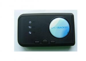
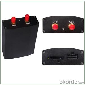
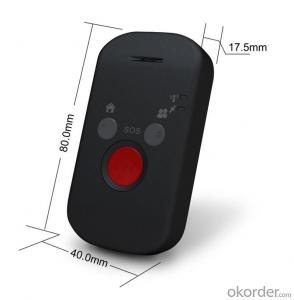
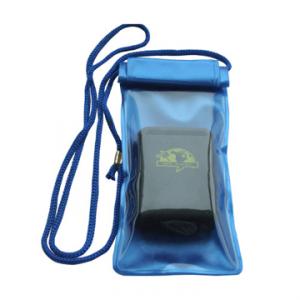
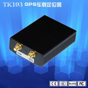
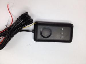
Person and Pet Mini GPS Tracker
- Ref Price:
-

- Loading Port:
- China Main Port
- Payment Terms:
- TT or LC
- Min Order Qty:
- 1 Piece pc
- Supply Capability:
- 1000 Pieces per Week OEM pc/month
OKorder Service Pledge
OKorder Financial Service
You Might Also Like
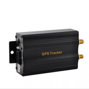
Detailed Product Description
|
Total Specifications | |
|
67*47*17(mm) | |
|
Unit Net Weight |
37g (without battery) |
|
Unit Gross Weight |
59g (total) |
|
Memory |
64 M bit NOR flash and 32 M bit SRAM |
|
Key |
Power button |
|
SOS button | |
|
Directly phone calling button(B)(hang up) | |
|
Directly phone calling button(C)(answer) | |
|
LED |
GSM work status |
|
Battery status | |
|
GPS status | |
|
IO interface |
5-pin Mini-USB(inside the shell) connector with USB virtual port(configuration the device with the PC software tool) |
|
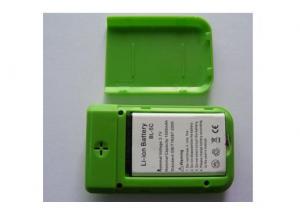
Battery
|
1000 mA, rechargeable Li-Ion battery Max 140 hrs working time |
|
Adaptor |
Input: AC 100~ 240 V, 0.3 A Max Output: DC5 V, 0.5 A |
|
| |
|
High performance 32-bit RISC | |
|
Software OS |
Multitask real time OS |
|
GSM feature |
Dual band GSM900/1800 MHz Quad band GSM850/900/1800/1900 MHz |
|
GPRS Protocol |
GPRS Class B GPRS Class 10 |
|
| |
|
High sensitivity GPS chipset | |
|
GPS sensitivity |
-159Db |
|
GPS frequency |
L1, 1575.42 MHz |
|
GPS Position Accuracy |
5m-25m |
|
GSM Position Accuracy |
100m-500m |
|
Velocity Accuracy |
0.1 m/s |
|
Time Accuracy |
Synchronized to GPS time |
|
Altitude Limit |
18,000 meters (60,000 feet) max. |
|
Velocity Limit |
515 meters/second (1000 knots) max. |
|
Cold start: |
36 sec. |
|
Warm start: |
33 sec. |
|
Hot start: |
2 sec. |
|
Channels: |
20 parallel channels |
|
Assist GPS |
Support (default) |
|
| |
|
0°C to 50°C | |
|
Storage Temp : |
-20°C to 60°C |
|
Humidity |
5% to 95% Non-condensing |
|
Waterproof |
NO |
- Q:GPS locator platform to show off how is going on
- GPS locator platform display offline two cases:First, the GPS locator dropped (wiring) can not electrify.
- Q:How to cancel QQ service positioning system
- Set the privacy locator service to find QQ then close
- Q:Which kind of GPS locator is better, generally how much money?
- This is only more than and 100 you can go to see Huizhi Albert PG02 Alibaba,Shenzhen, okay, I spent almost a year.
- Q:is not to buy a GPS to buy a tracking locator to track the target?I'd like to have one on a speed change bicycle
- The information sent to the software platform, you can check your car through the platform position. The effect of GPS tracking anti-theft is really very good, I would like a fitted, because my bike is stolen, I have lost two bikes, Xiangqilaijiu sad, so I must want to buy a GPS locator, the running track of who would come to steal you can see the car through the platform to find the car.
- Q:My phone does not have a GPS positioning system
- To buy a cell phone, this is a hardware problem
- Q:GPS locator sn7150509272 what brand
- thisSn7150509272Just an identification number,,,, can't see the brand
- Q:FiveFor example, tied in the hands of children, the elderly, the family can see the child through the mobile device, the elderly where they are now. Lost can also find back? But the vast majority of the need for SIM cards, there is no need for a similar SIM card locator? Can you recommend a brand?
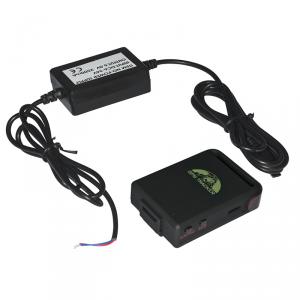
- There is no need to insert the SIM card GPS locator? FiveFor example, tied in the hands of children, the elderly, the family can see the child through the mobile device, the elderly where they are now. Lost can also find back? But the vast majority of the need for SIM cards, there is no need for a similar SIM card locator? Can you recommend a brand?Kissno07Recommended 2016-02-05 06:57:58 best answerPositioning principle:Positioning satellite signal to obtain latitude and longitude,And then upload the latitude and longitude to the server through the network,The server analyzes the specific location,People search the location of the locator by phone or computer;If there is no SIM card, then the latitude and longitude of the device can not be issued, we can not query the location of the device, so there is no SIM card GPS locator does not exist;If applied to navigation, you do not need to upload latitude and longitude information, direct calculation of latitude and longitude in the local navigation and then you can, do not need a SIM card.
- Q:the battery can be replaced, frost resistance, waterproof, when the horses mobile phone can receive text messages over speeding horsesIt is best to wear a belt, worn on the neck of the livestock is convenient, not easy to fall, similar to the release of the northeast tiger Putin that is the best
- 2, the platform function of the two trajectory query (trajectory query, track playback):Trajectory query: automatic recording and can be used to query the historical trajectory. Design the best route. Describe the name, location time and location information of the person or vehicleTrack playback: according to the time, the dynamic playback of the real trajectory, the action line at a glance, support for trajectory download.Automatic playback of a historical track, check personnel and vehicle trajectories in a period of time, a route optimization analysis for managers and employees of collective, summarize the successes and failures, and improve the strength and efficiency of the whole team.
- Q:Car GPS positioning system a month how much flow enough ah
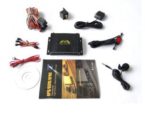
- GPS is a satellite navigation, if you have a map of the navigation software package, do not need to flow, if you do not download the map package, 2 hours basically use the seventy or eighty megabytes. So at least a month to more than 1G.Car GPS positioning system is based on GSM/GPRS network and GPS satellite positioning system, SMS or other means of remote vehicle positioning or monitoring. With mileage statistics, ACC detection function, power failure alarm function.First, the vehicle scheduling, unified management and scheduling of all vehicles in the control center to reduce the empty driving, improve the effective use of vehicles and road resources;Two, burglary and robbery, through real-time query vehicle location, timely recover stolen vehicles, to avoid causing significant economic losses, and the GPS locator system integrated with the general alarm function, the driver in case of an emergency can be immediately to the company or the 110 alarm, the first time to seek help;Three, data acquisition, management platform by collecting all the vehicle positioning information, unified processing and release to the relevant units or platform, to achieve the purpose of information sharing and cooperation;Four, video monitoring, through the installation of cameras, the car driver to upload pictures to the server, can ensure that the accident or crime can be found in the relevant personnel promptly, protect the driver's personal and property safety.
- Q:Car GPS locator installed in the car where the location is good
- Door partition;Under the trim panel under the windshield;Front bumper, need to pay attention to waterproof;Under the windshield wiper, need to pay attention to waterproof
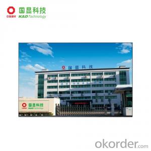
1. Manufacturer Overview |
|
|---|---|
| Location | Guangdong,China |
| Year Established | 2008 |
| Annual Output Value | |
| Main Markets | 30.00% Western Europe 30.00% North America 10.00% Eastern Europe 10.00% South America 5.00% Southern Europe 5.00% Northern Europe 2.00% Eastern Asia 2.00% Mid East 2.00% Oceania 2.00% Africa 2.00% Southeast Asia |
| Company Certifications | ISO 9001:2000 |
2. Manufacturer Certificates |
|
|---|---|
| a) Certification Name | |
| Range | |
| Reference | |
| Validity Period | |
3. Manufacturer Capability |
|
|---|---|
| a)Trade Capacity | |
| Nearest Port | |
| Export Percentage | 61% - 70% |
| No.of Employees in Trade Department | 6-10 People |
| Language Spoken: | English, Chinese |
| b)Factory Information | |
| Factory Size: | |
| No. of Production Lines | |
| Contract Manufacturing | |
| Product Price Range | |
Send your message to us
Person and Pet Mini GPS Tracker
- Ref Price:
-
- Loading Port:
- China Main Port
- Payment Terms:
- TT or LC
- Min Order Qty:
- 1 Piece pc
- Supply Capability:
- 1000 Pieces per Week OEM pc/month
OKorder Service Pledge
OKorder Financial Service
Similar products

New products
Hot products


Related keywords

