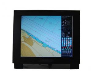
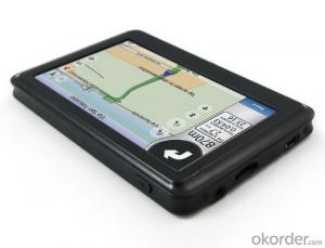
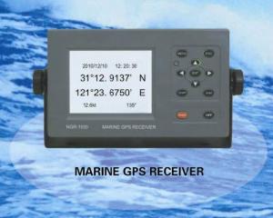
Marine GPS
- Ref Price:
-

- Loading Port:
- China Main Port
- Payment Terms:
- TT or LC
- Min Order Qty:
- 1 Set/Sets set
- Supply Capability:
- 1000 Set/Sets Per Year set/month
OKorder Service Pledge
OKorder Financial Service
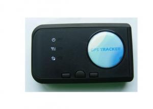
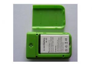
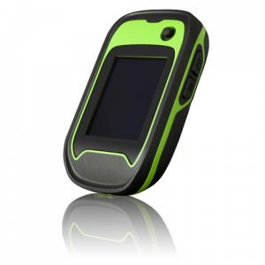
You Might Also Like


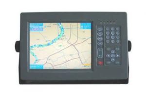
Features of Marine GPS
- Designed to comply with the latest standards and resolutions set by IMO, IHO and IEC.
- The electronic charts to be used are compatible with S-57 format.
- The inputs include GPS, AIS, HDG and other data.
- For GPS data, either internal GPS or external GPS input is applicable.
- CCStype approval.
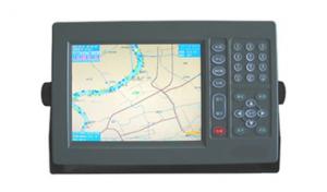
Specifications of Marine GPS
Display |
|
Resolution: | 1280 x 1024 |
Color: | TFT |
Display Area: | 17” or 19” |
Interface |
|
Input/Output: | 1. AIS input (RS232 and RS422) 2. GPS input/output (RS422) 3. HDG input/output (RS422) |
Data Format: | IEC61162-1, -2 |
Data Display |
|
Own Ship: | Position, COG, SOG, Heading |
Route: | Planned route, Monitored route |
ARPA Targets: | Range, Bearing, Speed, Course, CPA and TCPA |
Others: | EBL, VRM |
Route/Waypoint: | More than 100 routes, 200 waypoints/route |
Power supply |
|
Processor: | DC24V |
Display Unit: | DC24V |
- Q:(listed as the following 4 points) due to the literature in this area is not easy to find.. So God help you a lot of trouble ~ if you have the relevant Chinese and English (the best English), then sent to The more, the better..1 development process: divided into several stages, major events of the year, turning point, the extent of the current application, advantages and disadvantages2 technical issues: key technologies, difficulties and limitations3 outlook4 GPS in the field of enlightenment to us
- 1.7 other applicationsThe navigation technologies used in this paper are as follows: GPS (GNSS); sonar technology; INS; navigation chart; radio navigation technology; image matching technology; other technologies.The communication technology mainly includes: FM and TV subcarrier unidirectional data / voice communication; beacon network bidirectional data communication; trunking communication; cellular communication; digital land mobile communication; satellite mobile communication; traffic trail communication etc..The first 5 kinds of communication technologies are mainly used in coastal, inland river and lake area.
- Q:The use of sudden power system and then restart the game GPS said the problem needs to be closed
- Uninstall Downloadm,Reinstall barCompass party
- Q:Application of satellite positioning system
- 11 geodetic measurements of various levels12 road and various line lofting13 underwater topographic survey14 crustal deformation measurement, dam and large building deformation monitoring15.GIS application16 construction machinery (tyre crane, bulldozer, etc.) control17 the application of precision agriculture GPS in road engineering is mainly used for the establishment of a variety of road engineering control network and the determination of external control points, etc.. With the rapid development of highway, puts forward higher requirements for the survey, due to the long lines of known points less, therefore, measured by conventional means of distribution network not only difficult, but it is difficult to meet the requirements of high precision. In the country has adopted GPS technology to establish high-precision control network line head, and then use conventional methods laid wire encryption. Practice has proved that the error in the tens of kilometers within the range of only about 2 cm, to achieve the accuracy of the conventional method is difficult to achieve, but also greatly ahead of schedule. GPS technology is also applied to the control of large bridge. Because no visibility, can constitute a strong network, improve the precision of points, but also very effective fulcrum for testing conventional measurement. GPS technology is also widely used in tunnel measurement, GPS measurement no visibility, reduce intermediate links, so the conventional method, high speed and high precision, which has obvious economic and social benefits.
- Q:Who can give a world map of the great navigation era OL
- Give you an e-mail address to send a GPS software, he has spent half a year. security
- Q:Small fishing boat. A remote fishing village. Reef。 Map。,,,,,,,,,,,,,,,,,,,,,,Know the trouble to help ah... Thank you.
- In addition, the inside of the electronic chart is estimated to be purchased separately! You can only buy you often sea area of activity is good, but you are more remote, no large scale chart response can be used, as you said the reef, as long as you know, marked out on the line in the electronic map on the sea!
- Q:It's like the captain's studioSome M me
- I've heard it, but I haven't done it,It seems that only the GPS can be used to measure
- Q:Relative positioning of navigation instruments
- Instrument for radio positioning of ship. The current range finder, etc. a consol system and Roland, Taiwan card, Omega, transit navigation and hyperbolic system. Each has its own advantages and disadvantages, can be used to complement each other, but can not replace each other. The ideal positioning system has yet to be developed, which requires global, all-weather, self-contained, passive, fully reliable and high precision. Omega and transit navigation system has been called the two great achievements since 1960s of navigation technology, but they are only part of the above conditions. The United States in the late 80s will be officially put into use in the new satellite navigation system, known as the GPS global positioning system. It can be continuous positioning, the accuracy is higher than the meridian navigation system, is the ideal positioning system further new technical achievements.
- Q:Ancient navigation depends on navigation
- According to the "Zheng He Zheng He" charts, using hydrographic needle (24/48 azimuth compass navigation) with Ocean Star drawing operation (celestial navigation), at that time is the most advanced navigation technology. Zheng He's fleet, the day with the compass navigation, night watch stars and method is used to keep water compass heading.
- Q:Three necessary conditions of ancient ocean navigation is: ______ navigation, use the rudder steering, the effective use of ______.
- Three necessary conditions of ancient ocean navigation is: use the rudder steering, effective use of wind with compass navigation,.The answer is: compass, wind
- Q:OL, what is the meaning of the removal of the entire team in holy navigation? What is the use?
- For example, I have the ability to disperse, you and I team, you make a rat on the ship, I can help you solve
1. Manufacturer Overview |
|
|---|---|
| Location | Jiangsu,China |
| Year Established | 2008 |
| Annual Output Value | US$1 Million - US$2.5 Million |
| Main Markets | Mid East;Eastern Europe;South America |
| Company Certifications | |
2. Manufacturer Certificates |
|
|---|---|
| a) Certification Name | |
| Range | |
| Reference | |
| Validity Period | |
3. Manufacturer Capability |
|
|---|---|
| a)Trade Capacity | |
| Nearest Port | Shanghai |
| Export Percentage | 81% - 90% |
| No.of Employees in Trade Department | 150 |
| Language Spoken: | English, Chinese |
| b)Factory Information | |
| Factory Size: | Above 20,000 square meters |
| No. of Production Lines | 20 |
| Contract Manufacturing | OEM Service Offered;Design Service Offered |
| Product Price Range | Average |
Send your message to us
Marine GPS
- Ref Price:
-
- Loading Port:
- China Main Port
- Payment Terms:
- TT or LC
- Min Order Qty:
- 1 Set/Sets set
- Supply Capability:
- 1000 Set/Sets Per Year set/month
OKorder Service Pledge
OKorder Financial Service
Similar products
New products


Hot products
Related keywords

