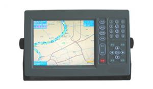
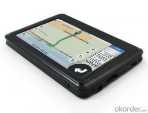
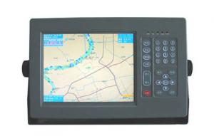
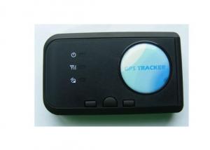
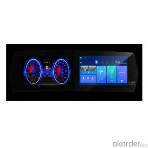
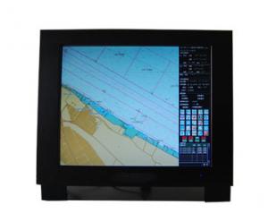
Marine GPS Navigator 1008
- Ref Price:
-

- Loading Port:
- China Main Port
- Payment Terms:
- TT or LC
- Min Order Qty:
- 1 Set/Sets set
- Supply Capability:
- 1000 Set/Sets Per Year set/month
OKorder Service Pledge
OKorder Financial Service
You Might Also Like


Physical & Performance of GPS Navigator | |
Unit dimensions, WxHxD | 5.9" x 6.1" x 2.4" (15.0 x 15.5 x 6.1 cm) |
Display size, WxH | 3.0" x 4.0", 5.0" diagonal (7.6 x 10.2 cm, 12.7 cm diagonal) |
Display resolution, WxH | 480 x 640 pixels |
Display type | VGA display |
Weight | 1.7 lb (0.8 kg) |
Battery | none |
Battery life | none |
Waterproof | Yes (IPX7) |
High-sensitivity receiver | Yes |
Antenna | internal |
NMEA input/output | NMEA 0183 compatible and NMEA 2000® certified |
Power consumption | 0.6A at 12V; 0.3A at 24V
0.8A at 12V; 0.4A at 24V (with sonar) |
Maps & Memory of GPS Navigator | |
Basemap | Yes |
Preloaded maps | No |
Ability to add maps | Yes |
Built-in memory | none (cannot load maps to internal memory) |
Accepts data cards | dual microSD™ card slots |
Waypoints/favorites/locations | 5,000 |
Routes | 100 |
Track log | 50,000 points; 50 saved tracks |
Features & Benefits of GPS Navigator | |
Touchscreen | No |
Supports AIS (tracks target ships' position) | No |
Supports DSC (displays position data from DSC capable VHF radio) | No |
Audible alarms | Yes |
Tide tables | Yes |
Hunt/fish calendar | No |
Sun and moon information | Yes |
Automatic routing (turn by turn routing on roads) | No |
Headphone jack/audio line-out | No |
Audio/video input/output | No |
Portable | No |
Automotive/motorcycle-friendly | No |
- Q:Is there any navigation aid in the era of OL? Download address!
- So we can look at the plug-in can be used: simple tour, download the address to find Baidu.
- Q:(listed as the following 4 points) due to the literature in this area is not easy to find.. So God help you a lot of trouble ~ if you have the relevant Chinese and English (the best English), then sent to The more, the better..1 development process: divided into several stages, major events of the year, turning point, the extent of the current application, advantages and disadvantages2 technical issues: key technologies, difficulties and limitations3 outlook4 GPS in the field of enlightenment to us
- 1.7 other applicationsThe navigation technologies used in this paper are as follows: GPS (GNSS); sonar technology; INS; navigation chart; radio navigation technology; image matching technology; other technologies.The communication technology mainly includes: FM and TV subcarrier unidirectional data / voice communication; beacon network bidirectional data communication; trunking communication; cellular communication; digital land mobile communication; satellite mobile communication; traffic trail communication etc..The first 5 kinds of communication technologies are mainly used in coastal, inland river and lake area.
- Q:Who can give a world map of the great navigation era OL
- Give you an e-mail address to send a GPS software, he has spent half a year. security
- Q:Mainland China has no big navigation era OL ah
- From 2005, 2007s to Xuanming Sheng later boss. Money run away once, stop in March, again in November 2007 to open service, 3 years after the November 2010 3S expiration of the contract again because developers and agents China wing tour of Japan's glorious renewal could not agree on stop, until now has not reopened, went to the old game player the service station.
- Q:Navigation and longitude latitude
- The direction of the East and West, which is gradually shortened from the equator to the north and south polesThe equator to the Antarctic latitude, equatorial North latitude.
- Q:also do navigation aviation related products, which is the key?
- The Garmin product positioning is, outdoor communications products, so it is difficult to say which is the key, take the following data contrast:Unit sales accounted for in the fourth quarter of 2016Car navigation mobile device 11.43%Aviation equipment 5.11%Fitness equipment 24.12%Navigation equipment 27.05%Outdoor equipment 11.29%Which car navigation and mobile terminal device is the overall share of the decline, the rest are in a state of steady rise.
- Q:How to use navigation
- Navigation: enter the game - open the HolyNavi.exe- role - choose your character will be able to useAssistant: navigation assistant - the game started by Home- - their own settings can also be used
- Q:OL, what is the meaning of the removal of the entire team in holy navigation? What is the use?
- Seeing the name of a thing one thinks of its function! Navigation auto lift negative state. Of course, the premise must have the relevant skills and props, that is, to facilitate the use of offshore players, leisure function.
- Q:How did ancient people navigate and navigate
- The initial navigation observation of the sun by day night observation height, Polaris azimuth to determine latitude, rely on the celestial positioning, navigator using a very simple instrument to measure the angle of celestial bodies, called "Jacob rod". The observer has two poles connected at the top, bottom and above the horizon, a celestial alignment (star or sun), can measure angle. Then calculate the latitude and the range by using the difference of the declination. This technique is called "latitude navigation", but it is very difficult to determine longitude. Nevertheless, the method of "latitude" is still widely used in Western Europe, placing itself at the same latitude as the destination, and then keeping it on the line until it reaches its destination. But this is not entirely scientific, even today, still using astronomical positioning error in 1-2 nautical miles, there was almost no decent navigation tools, imagine the error.
- Q:it is best to be able to open, can automatically follow, like the kind of sacred navigation. To be able to serve the country.
- National service has not yet assisted,But you have to believe that the talent of China is infinite. It won't be long before someone comes out
1. Manufacturer Overview |
|
|---|---|
| Location | Jiangsu,China |
| Year Established | 2008 |
| Annual Output Value | US$1 Million - US$2.5 Million |
| Main Markets | Mid East;Eastern Europe;South America |
| Company Certifications | |
2. Manufacturer Certificates |
|
|---|---|
| a) Certification Name | |
| Range | |
| Reference | |
| Validity Period | |
3. Manufacturer Capability |
|
|---|---|
| a)Trade Capacity | |
| Nearest Port | Shanghai |
| Export Percentage | 81% - 90% |
| No.of Employees in Trade Department | 150 |
| Language Spoken: | English, Chinese |
| b)Factory Information | |
| Factory Size: | Above 20,000 square meters |
| No. of Production Lines | 20 |
| Contract Manufacturing | OEM Service Offered;Design Service Offered |
| Product Price Range | Average |
Send your message to us
Marine GPS Navigator 1008
- Ref Price:
-
- Loading Port:
- China Main Port
- Payment Terms:
- TT or LC
- Min Order Qty:
- 1 Set/Sets set
- Supply Capability:
- 1000 Set/Sets Per Year set/month
OKorder Service Pledge
OKorder Financial Service
Similar products
New products
Hot products
Related keywords

