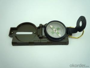


Army Direction Compass DC45-2A
- Ref Price:
-

- Loading Port:
- China Main Port
- Payment Terms:
- TT OR LC
- Min Order Qty:
- -
- Supply Capability:
- -
OKorder Service Pledge
OKorder Financial Service
You Might Also Like
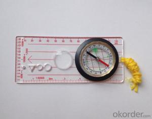
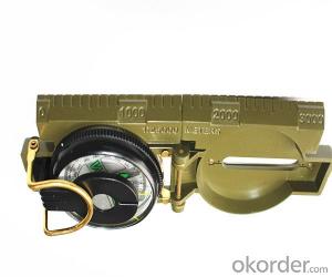

Specifications
Model: DC45-2A
Name: outdoor hiking or military compass and army compass, metal compass and marching compass in aluminium material
Product Origin: China
Supply Ability: 40,000 pcs/month
Minimum Order: 100 pcs
MOQ for OEM package: 500pcs
Detailed Product Description
Product Size: 80*58*32 (mm)
Color: Black
Material: Aluminium Alloy
Features:
1)Can easily folds to fit in your pocket
2) The compass is highly accurate and features a liquid-damped compass card with a luminous dial that can easily
be read at night, and a standard bezel with two yellow lines at 45 degree angles
3) The compass card has both the standard 0 - 360 degree scale, as well as the 0 - 64Mil scale (one yard at 1,000 yards)
4) The bezel rotates with detents every 3 degrees so you can change the heading reference a known amount without looking at the compass
5) The front sight has a magnifier to simultaneously view the magnetic heading when taking a sight
6) A second magnifier assists in reading the magnetic heading when direct viewing from above
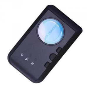
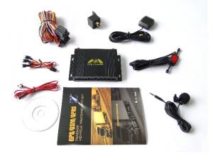
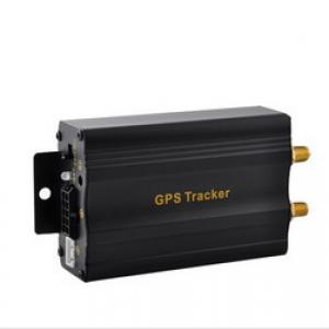
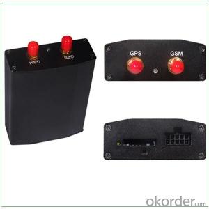
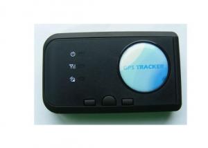
- Q:GPS locator tracker is always in the offline state is how to send text messages are appropriate. Send text messages back. WeChat or this.Baidu is the time to look at the map display offline
- Two, the phone can get through but platform show offline (with rice GPS locator for example)?A: 1, first try to query the state, STATUS# query GPRS state if disconnected link down, enter the, if the GPRS state is connected to the platform link up, enter the view.2, the instruction PARAM# to see whether the corresponding IMEI number, if the display 38160000000000168 IMEI number has been lost need to return to the factory.
- Q:At present, the global positioning system (GPS), vehicle positioning accuracy can be increased to less than 3 meters, if so, what is the theoretical basis? If not, what is the reason?
- If not, it should be a signal problem in your area.
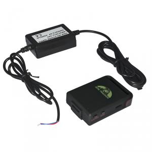
- Q:What is the car anti-theft locator?
- GPS system called "global positioning system", in fact, this technology is the United States spent $about 10000000000, which lasted more than 20 years of development of a large space engineering, the initial use of the main war. Later, GPS technology in the field of non military has been more in-depth application, in the field of automotive anti theft security achieved practical results. GPS satellite positioning system is a network type anti-theft device, it mainly depends on the purpose of locking ignition or starting to achieve security. GPS main use of satellite monitoring center of the vehicle 24 hours uninterrupted, high-precision monitoring services. GPS mobile terminal of the system installed in the command center of the central control system, mounted on the vehicle and GSM communication network, receiving location information from global positioning satellites, calculates the longitude, latitude, speed and direction of moving targets, and the use of short transmission information platform GSM network as the communication medium to achieve the positioning information the. This all-weather service is very effective, but its shortcomings are obvious: the price is expensive, a monthly fee to pay a service fee.
- Q:Not exactly what kind of express orders, the goods is how to achieve GPS positioning. Or the cargo is equipped with satellite locator, or what kind of.
- Regular express have GPS positioning, and the road car handle is a one-time thing to seal up
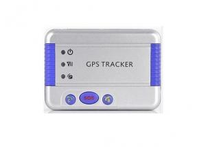
- Q:What are the reasons for the GPS locator offline?
- Second, no electricity.GPS GPS locator locator will offline when shutdown or failure, this number can use mobile phone to dial equipment SIM card, if you can not get through to the device and the number to send text messages without reply, that is the equipment or power supply line current and voltage instability the third point, communication module GPS locator (GSM module) is a problem, if it is for this reason it is important to contact the manufacturers to replace the GSM module. Fourth points, your car is on signal Blind platform can not receive GPS locator information, of course, display off.
- Q:How to solve the GPS locator arrears
- Contact you to buy gps suppliers to pay the deposit can be
- Q:If the use of GPS positioning products which brand is good?
- Method for effectively avoiding accidental loss of old people;1, in the elderly who contact the phone number and home address.2, as soon as possible in the elderly or mild Alzheimer's disease treatment as soon as possible.3, the use of GPS positioning products placed on the elderly, such as: coordinates to send the locator with positioning function, a key alarm function, security fence function, low alarm function. The guardian to install a mobile phone APP mobile phone to send the coordinates in the elderly, can see through the APP position at any time, press the alarm button can also help the elderly encounter danger, so as not to worry about the old man accidentally lost.
- Q:Mobile phone can be tracked after the closure of the GPS?
- Can. Jia trillion mobile phone signal monitoring technology can detect.GPS is the English Global System (Global Positioning System), referred to as Positioning, is currently the most widely used positioning, navigation systems. GPS started in 1958, a project of the U.S. military, put into use in 1964, by the year, the global coverage of up to 98% of the 24 GPS satellite constellation has been completed. Now almost all of the intelligent mobile phone equipped with a GPS service, as long as the open GPS, we can use mobile phone navigation, shooting photos with location information, you can also use some cool and we are related to the position of mobile phone application. In addition, GPS can also help monitor the operation of the vehicle route, the location of the field staff, etc..
- Q:The simplest and easiest language to say. Do not professional, do not understand......
- Whether it is GPS or A-GPS, are mainly to receive satellite navigation signal using GPS navigation chip equipment, and GPS chip receiving satellite navigation signals are free of charge, but the positioning time is very slow, because it will take a few minutes to wait for a satellite to locate the GPS module to the navigation on your device. A-GPS based on the receiving satellite navigation signal, but also through the network (GPRS) to get you the instant communication equipment operation base station information (signal base seat), you can easily find the instant seat, let the satellite fast positioning of your equipment. So the A-GPS than the GPS positioning time soon.
- Q:Method of use of GPS
- 2 no map use. 1) the use of road point: commonly used to determine the coordinates, to determine the rock caves as starting point, line or other coordinates, the coordinates of the point of turning. Easy to use, MARK a coordinate on the line. Find a point: to find the location must have to sign (landmark/waypoint) exists in the form of GPS in the memory, you can MARK or from previously visited a friend to get data, manual / computer into sign data upload. Press the GOTO key to select your destination from the list, and then go to the "guide" page, which will show you away from the target distance, speed, direction of the target angle and other data, according to the direction angle can be. 2) use the route input route: if you can find the route information recorded by the previous friends, type them into the GPS to form a line, or (usually return to the original road) to edit the previously recorded road sign into a line. Route guidance: put a route according to the activation, and looking for "the same way," guidance "page will lead you to the first point, the route once arrived, the target will automatically replace the next road," guidance "page to lead you to the line of second points if you deviate from... The route over some intermediate point, once you go back to the line," targeting "you will skip around those points, for your current position corresponding to the next point on the line. 3) backtracking is actually a special method of input line (route), it is very easy to return to the original path.
1. Manufacturer Overview |
|
|---|---|
| Location | |
| Year Established | |
| Annual Output Value | |
| Main Markets | |
| Company Certifications | |
2. Manufacturer Certificates |
|
|---|---|
| a) Certification Name | |
| Range | |
| Reference | |
| Validity Period | |
3. Manufacturer Capability |
|
|---|---|
| a)Trade Capacity | |
| Nearest Port | |
| Export Percentage | |
| No.of Employees in Trade Department | |
| Language Spoken: | |
| b)Factory Information | |
| Factory Size: | |
| No. of Production Lines | |
| Contract Manufacturing | |
| Product Price Range | |
Send your message to us
Army Direction Compass DC45-2A
- Ref Price:
-
- Loading Port:
- China Main Port
- Payment Terms:
- TT OR LC
- Min Order Qty:
- -
- Supply Capability:
- -
OKorder Service Pledge
OKorder Financial Service
Similar products

New products

Hot products